One of my favorite activities in an airliner is to point a camera out the window and snap pictures. The geomorphologist and map fiend in me thrills at seeing the various landscapes whip by in life-like detail. It's almost like a spaceship travelling above the surface of another planet!
The recent trip from Las Vegas to Sacramento, through San Diego, was in a Southwest Airlines spaceship christened 'Spirit of New Mexico.' The craft had a pretty, yellow 'Land of Enchantment' paint job that, unfortunately, I couldn't appreciate (because I was inside the airliner). Photos taken Sunday afternoon and evening, January 22, 2006.
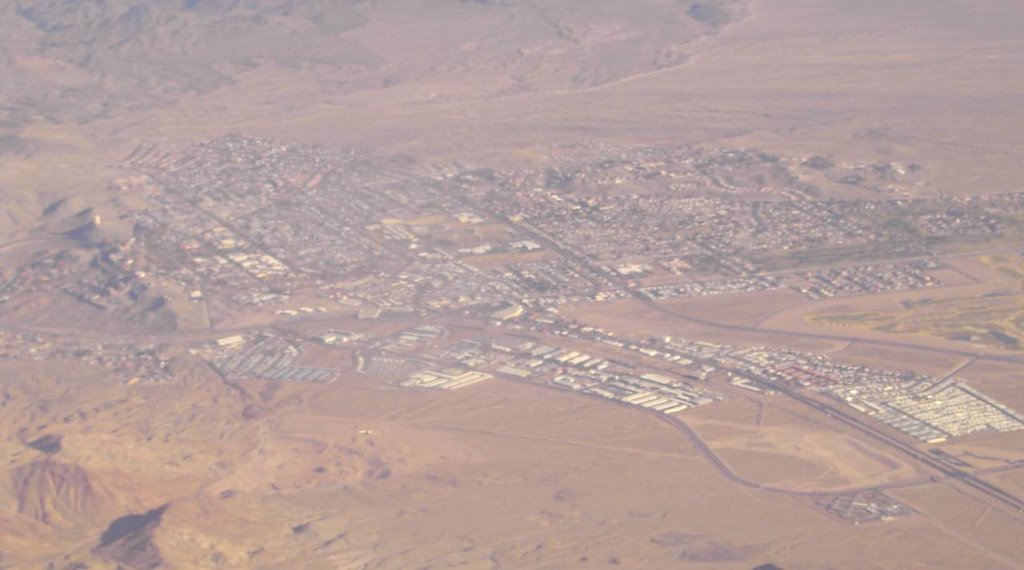 Boulder City, NV. Boulder City sits at the edge of the mesa overlooking Boulder Canyon, where Hoover Dam was built in the 1930's (towards the upper left of the photo). The construction workers were housed here. Most construction camps are dens of gambling and iniquity, but since this was Nevada, and Las Vegas wasn't very far away, Boulder City became instead a family-focused construction camp where high moral rectitude was practiced (and a deadly dull place on Saturday night).
 Eagle Mountain Open Pit Iron Mine (the gray gash just left of center), located just south of Joshua Tree National Park (to the left of the photo). Wispy clouds marred this shot of the Eagle Mountain open pit mine, where virtually all of the iron used to build ships for the Pacific theater was mined during World War II.
In the 90's, a large garbage dump meant to receive Los Angeles trash was proposed to fill the now inactive open pit. A decade later, the dump isn't there (probably too controversial). In general, there is an absence of environmental data for facilities like this: no one had ever contemplated building a dump this large in a place so dry before.
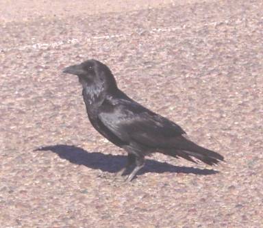 Ludlow Crow. Here is a Mojave Desert crow, a clever and intelligent bird that would nevertheless swiftly die, if not for the nearby Dairy Queen, located along Interstate 40 at Ludlow, CA. The Fish and Wildlife people worried a lot about crows like this one being attracted to a large garbage dump in the desert (next to cake cones and parfaits, crows like nothing better to eat than rare desert tortoises).
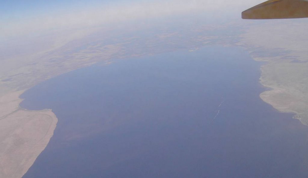 Salton Sea, and the fertile Imperial Valley beyond. Looking south, towards Mexico. On the right, San Felipe Creek flows into the Salton Sea. So much of our lettuce comes from here!
The Salton Sea was formed by a massive irrigation accident in 1905. Colorado River water poured for several years into this desert basin. Today, the Salton Sea continues to be sustained by Imperial Valley irrigation runoff. There is lots of wildlife in the area, but the area is susceptible to pollution and salinization problems.
 Fish Creek Mountains. Deceptive name! I wonder why it got that name? This place is so arid it seems to resemble Mars more than Earth. What a contrast between dark rock and light sand! The Imperial Valley is in the background.
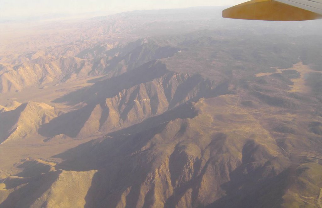 High plateaus NE of San Diego abruptly end with a dizzying drop. Amazing - it's like a wall! A dry-looking Cuyamaca Reservoir is evident at right. The reservoir is in the vicinity of Harrison Park, amongst the pines of the Cleveland National Forest.
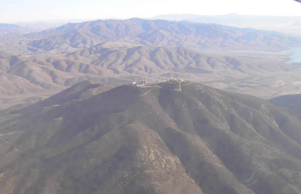 San Miguel Mountain, at the end of Millar Ranch Road, west of Jamul, and SE of San Diego. Looks like you can almost reach out and touch these radio and TV antennas! In the background, the San Ysidro Mountains form a backdrop behind Lower Otay Lake, just north of the international border. The mountains on the horizon are south of Tijuana, in Baja California Norte, Mexico.
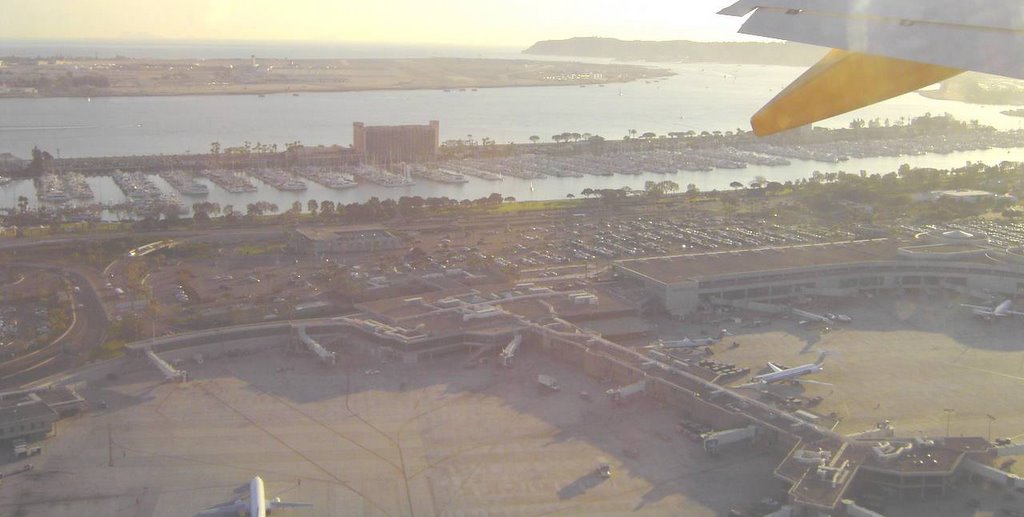 Familiar San Diego Bay! Lindbergh Field is in the foreground, with San Diego Bay and marina (and a hotel) in the middle, Coronado Island in the left background, and the rocky Point Loma peninsula in the right background.
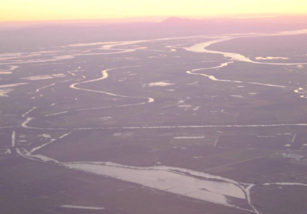 San Joaquin-Sacramento River Delta, looking SSW. Hoo boy, the Central Valley sure looks soggy in wintertime!
 The Sacramento River flows in a narrow band from right to left, past flooded fields in the foreground, turns right at Walnut Grove in the lower-left corner, turns left at Ryde, and then wiggles towards a triple-junction. At the triple junction, the river (left stream) meets Steamboat Slough (middle stream), and overflow from the Yolo Bypass (right stream).
Water from the fortified Sacramento River then flows past Sherman Island and meets the San Joaquin River (flowing from the left). Both rivers together flow towards Suisun Bay. From Suisun Bay (off the photo), water flows westwards towards San Francisco Bay. In the sunset, Mt. Diablo (which is east of the San Francisco Bay area) can be seen.
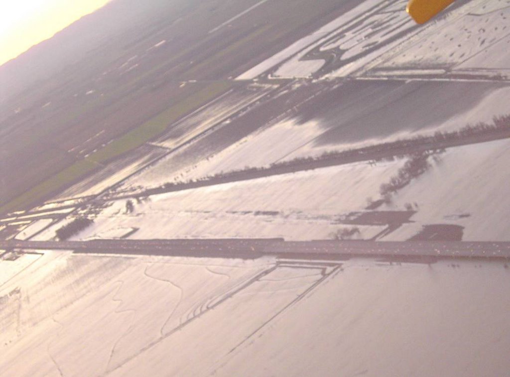 Yolo Causeway - Interstate 80, between Davis and Sacramento. I practically live on this bridge! Davis is to the left, and Sacramento is to the right. The freeway is the lower path; the railroad more-or-less parallels above.
 The Yolo Bypass is an alternate path for Sacramento River water to flow past Sacramento during wet winters. Sometimes, so much water pours from the Sierra Nevada, down the American River and into the Sacramento River (at downtown Sacramento) that the flow of the Sacramento River backs up, reverses, and flows north. Disaster is averted when the overflow spills into the Yolo Bypass, and flows harmlessly southwards again. Without this relief from raging floodwaters, life in Sacramento and vicinity would be very precarious indeed!
No comments:
Post a Comment