Let me know if you have any problems or questions (E-Mail address: valdezmarc56@gmail.com).
--------------------------

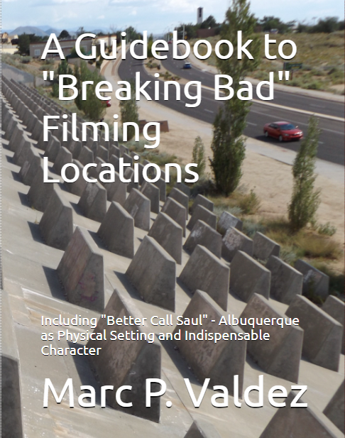
"A Guidebook To 'Breaking Bad' Filming Locations: Including 'Better Call Saul' - Albuquerque as Physical Setting and Indispensable Character" (Sixth Edition)
Purchase book at the link. This book outlines thirty-three circuits that the avid fan can travel in order to visit up to 679 different filming locations for "Breaking Bad" and "Better Call Saul" in the Albuquerque area. Some background is provided for each site, including other movies that might have also used the site for filming.
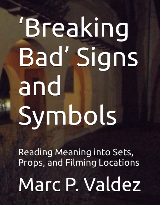
"‘Breaking Bad’ Signs and Symbols: Reading Meaning into Sets, Props, and Filming Locations” (Second Edition)
Purchase book at the link. “‘Breaking Bad’ Signs and Symbols,” aims to understand some of the symbolism embedded in the backgrounds of “Breaking Bad” and “Better Call Saul,” in order to decode messages and stories Vince Gilligan and crew have hidden there. A series of tables are used to isolate how certain (particularly architectural) features are used: Gentle Arches, Tin Ceilings, Five-Pointed Stars, Octagons, etc. Daylighting innovations that were either pioneered or promoted in Chicago are examined: Glass Block Windows, Luxfer Prismatic Tile Windows, and Plate Glass Windows.
Certain symbols advance the plot: foreshadowing symbols like Pueblo Deco Arches, or danger symbols like bell shapes and stagger symbols. Other features, like Glass Block Windows or Parallel Beams in the Ceiling, tell stories about the legacies and corruptions of modernity, particularly those best-displayed at Chicago’s “Century of Progress” (1933-34).
To avoid unnecessary friction, I have redacted the addresses of all single-family homes in these books. (These addresses are still available at Marc Valdez Weblog, however.) The pictures in the print editions are black-and-white, in order to keep costs down.
"A Guidebook To 'Breaking Bad' Filming Locations: Including 'Better Call Saul' - Albuquerque as Physical Setting and Indispensable Character" (Sixth Edition)
Purchase book at the link. This book outlines thirty-three circuits that the avid fan can travel in order to visit up to 679 different filming locations for "Breaking Bad" and "Better Call Saul" in the Albuquerque area. Some background is provided for each site, including other movies that might have also used the site for filming.
"‘Breaking Bad’ Signs and Symbols: Reading Meaning into Sets, Props, and Filming Locations” (Second Edition)
Purchase book at the link. “‘Breaking Bad’ Signs and Symbols,” aims to understand some of the symbolism embedded in the backgrounds of “Breaking Bad” and “Better Call Saul,” in order to decode messages and stories Vince Gilligan and crew have hidden there. A series of tables are used to isolate how certain (particularly architectural) features are used: Gentle Arches, Tin Ceilings, Five-Pointed Stars, Octagons, etc. Daylighting innovations that were either pioneered or promoted in Chicago are examined: Glass Block Windows, Luxfer Prismatic Tile Windows, and Plate Glass Windows.
Certain symbols advance the plot: foreshadowing symbols like Pueblo Deco Arches, or danger symbols like bell shapes and stagger symbols. Other features, like Glass Block Windows or Parallel Beams in the Ceiling, tell stories about the legacies and corruptions of modernity, particularly those best-displayed at Chicago’s “Century of Progress” (1933-34).
In addition, a number of scenes in the show are modeled after Early Surrealist artworks. The traces of various artists can be tracked in both shows, including: Comte de Lautréamont, Giorgio De Chirico, Man Ray, Max Ernst, Leonora Carrington, René Magritte, Toyen, Yves Tanguy, Remedios Varo, Paul Klee, and in particular, Salvador Dalí.
--------------------------
 The finale of Season 2 of "Breaking Bad" was enough to jar one's confidence in our travel infrastructure.
 Here, as our airliner flies over Albuquerque's Northeast Heights, with the Sandia Mountains as a backdrop, I clutch my Teddy Bear and nervously scan the horizon for poorly-vectored aircraft.
Albuquerque's Airport (called the 'Sunport') turned 70!
Here is a video reviewing the history of Albuquerque's Sunport.
It's curious how the deaths of individual people can reverberate through the years.
At 5:27 in this video, the narrator describes how, on Friday morning, February 19, 1955, poorly-vectored TWA Flight 260 crashed into the granite fins of the cloud-enshrouded west face of the Sandia Mountains. Sixteen people were killed.
A decade later, with the opening of Sandia Peak Tramway imminent, the crash debris was moved and hidden, since the path of the Tramway was going to pass nearly directly over the debris, and it was thought wise to prevent the site from becoming a ghoulish spectacle. Some debris was shoved into natural cave-like hollows at the base of the granite fins, and the rest was covered with logs, rocks, and dirt. Still, if you know where to look from the Tram, you can still spot shards of glass and other crash fragments glinting in the sun.
In the late 1970's, a friend and I visited the crash site. My friend was curious about the crash, since the wife of one his professors at New Mexico Tech in Socorro had been a passenger on this aircraft (more on this below).
We lingered too long amidst the shattered wreckage (where the impact's fire had partly melted the aluminum aircraft components). We were caught by sunset.
It can be dangerous getting caught in the Sandias by nightfall. Some people - like young Roy Rinks in 1969 - never made it out of the Sandias alive. We were lucky, however. A full moon swiftly rose and despite nightfall we were able to hike out of the area without much trouble or delay.
In Season 3, episode 1, ('No Mas') of "Breaking Bad", Walter White noted how swiftly society as a whole forgets large plane crashes - even catastrophes like the double jumbo jet crash at Tenerife - but that is society as a whole. Like my friend, people remember and honor the individual deaths, even of people they never had a chance to meet, even many years later. And even if the Wayfarer 515/King Air 350 collision was just the 57th worst aviation tragedy in history, the echoes of that accident will reverberate for decades.
[UPDATE - March 2, 2015: The February 2015 issue of "Albuquerque - The Magazine" (Vol. 11, No. 9, pp. 48 - 63) contains a great new article written by Adam R. Baca, with photos by Don James and Hugh Prather, regarding the crash of TWA Flight 260, and the long-running efforts by Hugh Prather and Larry DeCelles to clear the name of Captain Ivan Spong and First Officer Jesse James Creason, Jr., who were hastily-blamed for the crash. DeCelles had flown the Martin 404 and noted two previous occasions when the fluxgate compass displays (known as Radio Magnetic Indicators, or RMIs) gave incorrect readings:
DeCelles suspected a similar error might have been responsible for the flight crew directing this aircraft into the cloud-shrouded Sandia Mountains rather than around them.
The article also lists the passengers aboard, none of whom was a woman from Socorro, NM, although there was a geologist named Robert Balk from New Mexico Tech aboard. Already after twenty years, and hearing the story second-and-thirdhand, the memory of the event and its victims had been compromised somewhat. Which just goes to show Walter White's point, after all, that society forgets quickly!]
It's curious how the deaths of individual people can reverberate through the years.
At 5:27 in this video, the narrator describes how, on Friday morning, February 19, 1955, poorly-vectored TWA Flight 260 crashed into the granite fins of the cloud-enshrouded west face of the Sandia Mountains. Sixteen people were killed.
A decade later, with the opening of Sandia Peak Tramway imminent, the crash debris was moved and hidden, since the path of the Tramway was going to pass nearly directly over the debris, and it was thought wise to prevent the site from becoming a ghoulish spectacle. Some debris was shoved into natural cave-like hollows at the base of the granite fins, and the rest was covered with logs, rocks, and dirt. Still, if you know where to look from the Tram, you can still spot shards of glass and other crash fragments glinting in the sun.
In the late 1970's, a friend and I visited the crash site. My friend was curious about the crash, since the wife of one his professors at New Mexico Tech in Socorro had been a passenger on this aircraft (more on this below).
We lingered too long amidst the shattered wreckage (where the impact's fire had partly melted the aluminum aircraft components). We were caught by sunset.
It can be dangerous getting caught in the Sandias by nightfall. Some people - like young Roy Rinks in 1969 - never made it out of the Sandias alive. We were lucky, however. A full moon swiftly rose and despite nightfall we were able to hike out of the area without much trouble or delay.
In Season 3, episode 1, ('No Mas') of "Breaking Bad", Walter White noted how swiftly society as a whole forgets large plane crashes - even catastrophes like the double jumbo jet crash at Tenerife - but that is society as a whole. Like my friend, people remember and honor the individual deaths, even of people they never had a chance to meet, even many years later. And even if the Wayfarer 515/King Air 350 collision was just the 57th worst aviation tragedy in history, the echoes of that accident will reverberate for decades.
[UPDATE - March 2, 2015: The February 2015 issue of "Albuquerque - The Magazine" (Vol. 11, No. 9, pp. 48 - 63) contains a great new article written by Adam R. Baca, with photos by Don James and Hugh Prather, regarding the crash of TWA Flight 260, and the long-running efforts by Hugh Prather and Larry DeCelles to clear the name of Captain Ivan Spong and First Officer Jesse James Creason, Jr., who were hastily-blamed for the crash. DeCelles had flown the Martin 404 and noted two previous occasions when the fluxgate compass displays (known as Radio Magnetic Indicators, or RMIs) gave incorrect readings:
But during these two flights for DeCelles in 1954, the RMIs were inaccurate. On a flight landing in Dayton, Ohio, they showed the plane heading southeast rather than south. On a flight between Washington D.C. and Wheeler, W. Va., the RMIs gave a 180-degree error.
DeCelles suspected a similar error might have been responsible for the flight crew directing this aircraft into the cloud-shrouded Sandia Mountains rather than around them.
The article also lists the passengers aboard, none of whom was a woman from Socorro, NM, although there was a geologist named Robert Balk from New Mexico Tech aboard. Already after twenty years, and hearing the story second-and-thirdhand, the memory of the event and its victims had been compromised somewhat. Which just goes to show Walter White's point, after all, that society forgets quickly!]

--------------------
Cabezon Locations (NW Of Albuquerque)
 Cabezon Peak, as seen from the northeast, from NM State Highway 550 (formerly NM State Highway 44).
Season 3 starts out with very disturbing imagery - an unforgettable sequence of Mexicans, including two narcotraficantes, crawling along a dirt road through a small, tumbledown village towards a shrine in an attitude of abject suffering and religious supplication (apparently towards Santa Muerte). A Devil's Tower-like mountain looms in the background. The atmosphere is absolutely menacing.
The mountain is familiar to northwestern New Mexicans, of course: Cabezon Peak! The village is the near-ghost town of Cabezon, which is close to the lightly-inhabited village of San Luis. The valley in the distance is that carved by the Rio Puerco River.
 Mexican Village, with Shrine.
This is the town of Cabezon, NM, as seen from the distance (Season 3, episode 1, 'No Mas').
In this photo, the Cabezon town site, located at the base of the low mesa about half-a-mile in the distance, is viewed from the south.
In my high school days (about 1974), a friend named Dane and I visited the area. We had a mysterious car accident (story here). We spent the day climbing Cabezon Peak, which turned out to be easier to climb than I first feared (it's an older, more-eroded volcanic neck than Wyoming's more-famous Devil's Tower).
The upper Rio Puerco Valley was, and remains, a very, very hard place to make a living. The tiny villages of San Luis and Cabezon were the 'bleeding edge' of the Spanish Empire's colonization of the New World. In Spanish colonial times, the Navajos raided the area with impunity. The Spaniards were never successful in settling areas closer than this place to the Colorado Plateau fastness of the Navajo realm. The ephemeral edge of European civilization was right here!
Life here was brutal: merciless Indian attacks, cold weather, alkaline water and alkaline soil. And to top it all off, through the combined action of overgrazing and flash-flooding, the Rio Puerco has dug down deep enough into the soft soil that irrigation is all-but-impossible to carry out anymore. Thus, for traditional New Mexican agriculture, the valley is just one stop short of dead. It's no wonder that the towns in the Rio Puerco Valley are hollowed-out ghost relics of a brutal past! (The Rio Puerco Valley was populated, then abandoned, in two distinct periods: the mid-1700's, and 1866-1886. Reference: "The Founding of San Francisco on the Rio Puerco: A Document", Larry Lopez, New Mexico Historical Review, Vol. 55, No. 1, January, 1980, pp.71-78.)
For television folks, however, these towns are visually amazing. Such vistas! No wonder the "Breaking Bad" folks were attracted to these towns: attracted like bugs to a light!
Cabezon Peak held a delightful surprise on top when we visited years ago. The top was crawling with ladybugs! Similar phenomena can be found on other peaks in the Southwest and in California's Sierra Nevada. Here, in the middle of a near-wilderness not far from Albuquerque, the discovery seemed particularly welcome.
The imagery from "Breaking Bad" of people crawling through the dirt is so strong, however, that my memories of a real place, happy and trying memories alike, are in danger of being overprinted by memories of things that have never happened. Art is more real than reality!
 Left: A home in San Luis.
In May, 2011, I struck out northwest from ABQ seeking 'Breaking Bad' sites. (Highway 550 is one, principal corridor for Breaking Bad's out-of-town sojourns).
I made a profound discovery while passing the place where the road to San Luis meets NM State Highway 550 (formerly NM State Highway 44). Since my last visit 37 years ago they paved the road to the village of San Luis! Amazing! Even the dirt roads in the area seemed in amazingly-good shape. Come-on people, this isn't the traditional low standard of Sandoval County roads I thought I understood! I wonder if the good roads are a result of La Niña enduring for many months? It had barely-rained here for months! Whatever it was, I was encouraged - lured, even - to drop my timidity and take the econo Chevy Cobalt rent-a-car onto roads I would heretofore never have dared without a four-wheel-drive vehicle!
 Various pictures of Eerie Cabezon Peak!
Cabezon Peak as seen from the northwest, looking from that strange powerline road which heads to Torreon, NM, from San Luis.
 Cabezon Peak, as seen from the west.
 Cabezon Peak, as seen from the south.
A Tribute To Quivira, And The Seven Lost Cities Of Gold: Calexico's "Crystal Frontier"
(via Badtux, the Snarky Penguin).
Pizza Of Destiny
In the fall of 2017, their patience exhausted by recovering pizzas from the roof, the family living here had a fence built to keep people out.
(Season 3, episode 2, 'Caballo sin Nombre') Courtesy of Angela.
------------------------------
Season 3 Filming Locations
Northeast Heights (E. of Wyoming, W. of Juan Tabo, S. of Osuna)
------------------------------
Season 3 Filming Locations
Northeast Heights (E. of Wyoming, W. of Juan Tabo, S. of Osuna)
 Bingo Parlor, Silva Lanes, 3010 Eubank Blvd. NE.
(Season 3, episode 3, 'IFT') The cousins hijack a van here.
 Silva Lanes.
 Silva Lanes detail.
 CVS Pharmacy, located across the street from the Car Wash, at 9640 Menaul Blvd. NE, can be seen several times in the television series.
(Season 3, episode 11, 'Abiquiu') Walt's potential investment is across the street, at the car wash.
(Season 4, episode 2, 'Thirty-Eight Snub') Skyler's purchase is derailed.
 Gentle arch at CVS Pharmacy.
(Season 4, episode 3, 'Open House') Skyler's cunning succeeds!
 CVS Pharmacy.
 4's Cabaret, Chapter II Show Club, 2294 Wyoming Blvd. NE (Season 3, episode 5, 'Mas').
Jesse and friends party with strippers, using Walt's money as fuel.
 4's Cabaret, Chapter II Show Club, 2294 Wyoming Blvd. NE (Season 3, episode 5, 'Mas').
Jesse and friends party with strippers, using Walt's money as fuel.
 A drive west down Menaul Blvd., approximately 9200 Menaul Blvd. NE (Season 3, episode 11, 'Abiquiu').
Skyler and Walt discuss the Car Wash while driving down the street near the Car Wash. St. Luke's Lutheran Church is visible in the scene.
 ABQ Street, Residential street (Season 3, episode 12, 'Half Measures'). Walt doesn’t mind Flynn using both feet on the pedals.
Took me six years to finally get this location figured out! The scene was filmed near La Palomita Park, where La Sala del Oeste NE meets La Sala del Norte NE: 3400 and 3408 La Sala del Oeste NE, and 8610 La Sala del Norte NE.
 Mike's daughter-in-law Stacy's home, 8613 La Sala Del Centro NE (Season 3, episode 13, 'Full Measure'). Mike keeps half the balloons.
 Stacy's House.
Gale's Apt., said to be at 6353 Juan Tabo Blvd. NE #6, but Juan Tabo ends about the 6200 block (Season 3, episode 13, 'Full Measure').
Interior possibly on set. Alternatively, the interior might be in Jesse or Jane's apartment, since both places possess identical Pueblo Deco arches. Exterior is Mesa Verde Apartments, 4610 Eubank Blvd. NE, NNE corner of complex, looking west (Season 4, episode 1, 'Boxcutter': 35.133690ø, -106.531260ø). See Season 4 post for more details.
Upper Northeast Heights (E. of Juan Tabo)
 Walt's first single apartment at the 'Beachcomber', Mountain Vista Apartments, 1501 Tramway Blvd. NE.
(Season 3, episode 1, 'No Mas')
(Season 3, episode 2, 'Caballo sin Nombre')
 Beachcomber apartments swimming pool area, 2018.
 Hinkle Family Fun Center, 12931 Indian School Rd. NE, near Tramway Blvd. & Indian School Rd. (Season 3, episode 13, 'Full Measure').
Jesse hides out at this location. Exterior shots appear to have been shot at Hinkle's western building, whereas most interior shots appear to have been taken in the main, eastern building.
 Hinkle Family Fun Center, 12931 Indian School Rd. NE, near Tramway Blvd. & Indian School Rd. (Season 3, episode 13, 'Full Measure').
Jesse hides out at this location.
 Round Arch of the United Artists High Ridge 8 Theater, near Hinkle Family Fun Center, and sometimes visible in "Breaking Bad."
 Entrance at Hinkle Family Fun Center (east), with its gentle arch.
 Hinkle Family Fun Center (east).
 Entrance at Hinkle Family Fun Center (west)
 Hinkle Paintball Entry.
Starting in Season 2 of the "Breaking Bad" TV series, some of the on-campus J. P. Wynne High School scenes were shifted from the original Rio Rancho High School, and CNM's Westside Campus, to Eldorado High School in Albuquerque's Northeast Heights. The gym at Highland High School was used for the class assembly discussing the Wayfarer 515/King Air 350 collision (see the discussion in Season 1: "The High Schools of Breaking Bad").
 Paul's Monterey Inn, 1000 Juan Tabo Blvd. NE (Season 3, episode 12, 'Half Measures').
Jesse and Walt discuss killing thugs.
[UPDATE: February, 2015: Sad news that Paul's Monterey Inn will close after 40 years in business. This article from January, 2014 identifies tax issues as a major burden. And once again, time is quickly erasing the Albuquerque's "Breaking Bad" heritage.]
Northeast Heights (N. Of Osuna)
 Hank won't answer calls about getting transferred to El Paso. Appears to be Simms Park Rd. NE (Season 3, episode 4, 'Green Light'). Hank drives this stretch heading to Big Chief gas station. (35.160905°, -106.477327°)
  View towards the La Luz picnic area from the road to the base of the Tramway. This road is closer to the La Luz picnic area than Simms Rd., but gives a better view of those peaks in the background as Hank travels to the Big Chief gas station.
Lower Northeast Heights (W. of Wyoming), & Lomas Blvd. Corridor
 Parking Lot, 4600 Cutler Ave. NE (Season 3, Episode 7, 'One Minute').
Hank Shrader is ambushed in this parking lot, adjacent to I-40, near Washington and Menual Blvd. NE.
 Gus Fring's House, 1213 Jefferson St. NE.
(Season 3, episode 11, 'Abiquiu'). Gus and Walt eat 'paila marina'.
(Season 4, episode 2, 'Thirty-Eight Snub'). Mike interrupts Walt's plans.
 Gus Fring's House.
 Parked Car beside house, 4507 Robin Ave. NE (Season 3, episode 11, 'Abiquiu').
Jesse & Jane discuss Georgia O'Keefe's art.
Downtown

Skyler's Lawyer's Office, 3rd and Tijeras Ave. NW.
(Season 3, episode 1, 'No Mas')
(Season 3, episode 3, 'IFT')
(Season 3, episode 5, 'Mas')
(Season 4, episode 13, 'Face Off') Exterior only.
On my February, 2025 visit I tried to find the office they used for the scene, but failed. Too much time had passed, I presume.
Skyler decides against taking her lawyer's advice.
 Bernalillo County Court House Annex, Corner of 5th and Tijeras Ave. NW. This is the real Bernalillo County Courthouse, where Walter is released after being maced and arrested for fighting with the highway patrolman.
(Season 3, episode 2, 'Caballo sin Nombre')
(Season 4, episode 13, 'Face Off')
 Bernalillo County Court House Annex.
(Season 3, episode 2, 'Caballo sin Nombre')
(Season 4, episode 13, 'Face Off')
 Bernalillo County Court House Annex.
 Fourth St. and Central Ave. (Season 3, episode 5, 'Mas'). Time lapse montage, looking east.
Downtown West and Old Town
 Televised footage of the Huning Castle Apartments fire of August 4, 2009, at 15th St. & Central Ave., was used to represent the destruction caused by the mid-air collision and crashes of Wayfarer 515 and King Air 350 (Season 3, episode 1, 'No Mas').
 I added a short sentence to Wikipedia to this effect.
The actual footage used appears to have been from KOB, and no longer appears to be on the Web, but more-complete footage by KRQE is still up there.
 On my March 2014 visit, I noticed a replacement for Huning Castle is now under construction.
 On my July 2014 visit, I noticed Southwest Capital Bank now rests on the former site of the former Huning Castle Apartments.
Huning Castle & ABQ Country Club
 Beneke House, 16th & Laguna Blvd. SW (Season 3, episode 4, 'Green Light' - presumably interior - and episode 5 'Mas' - exterior).
 Beneke House, 16th & Laguna Blvd. SW (Season 3, episode 4, 'Green Light' - presumably interior - and episode 5 'Mas' - exterior).
 Beneke's Romantic Pad, with its gentle arches.
 Beneke's Romantic Pad, with its gentle arches.
 Beneke House, 16th & Laguna Blvd. SW (Season 3, episode 4, 'Green Light' - presumably interior - and episode 5 'Mas' - exterior).
 Beneke House, 16th & Laguna Blvd. SW (Season 3, episode 4, 'Green Light' - presumably interior - and episode 5 'Mas' - exterior).
 Kit Carson Park, Kit Carson Ave. and Alcalde Pl. SW (Season 3, episode 2, 'Caballo sin Nombre').
This is one of the parks where Mike's granddaughter played.
 Aircraft crash TV coverage, KOB Eyewitness News 4, 4 Broadcast Plaza SW (Season 3, episode 1, 'No Mas'). KOB is home of anchors Marla Tellez and Jeff Maher. Univision's KISS 97.3 DJ Dana Cortez and truTV's Open Court personality Ashleigh Banfield were also shown in the aircraft crash footage.
 The resources of KOB Eyewitness News 4 were used once again, to report on simultaneous prison stabbings (“Breaking Bad”, Season 5a, episode 8, ‘Gliding Over All’).
 Gomey makes a beverage run while surveilling with Hank just north of Old Town Parking Garage, at Mountain Road and 20th St. NW (Season 3, episode 3, 'IFT'). Looking east.
 Gomey makes a beverage run while surveilling with Hank just north of Old Town Parking Garage, at Mountain Road and 20th St. NW (Season 3, episode 3, 'IFT'). Looking south.
 Barelas
 Tomas Cantillo is found dead at Eddie Garcia Park, 8th and Eroy St. SW (Season 3, episode 12, ‘Half Measures’).
On “Breaking Bad”, the TV newscaster broadcasts the address as the 4700 block of 8th Avenue.
Please note, it's easy to get this location confused with the nearby park and playground areas of Barelas Community Center Park.
 Playground at Eroy and 8th St. SW.
 Cantillo House, 424 Cromwell Ave. SW.
 (Season 3, episode 11, 'Abiquiu'; Season 3, episode 12, 'Half Measures')
Huning Highlands/ Martineztown
(no new locations offered in this update).
University Area & Near Presbyterian Hospital
 Annapurna’s World Vegetarian Café is seen in the background as Jesse and his friends talk. Located at 2201 Silver Ave. SE, at Silver & Yale Blvd. SE (Season 3, episode 11, 'Abiquiu').


 Jesse seeks help at his Self-Help group, located at University Heights Methodist Church, 2210 Silver Ave. SE, at Silver & Yale Blvd. SE (Season 3, episode 9, 'Kafkaesque'; and Season 3, episode 11, 'Abiquiu').
  Jesse seeks help at his Self-Help group, located at University Heights Methodist Church, 2210 Silver Ave. SE, at Silver & Yale Blvd. SE (Season 3, episode 9, 'Kafkaesque'; and Season 3, episode 11, 'Abiquiu').
Nob Hill
 This complex near Silver & Morningside Dr. SE hosts Walt's new single apartment (starting with Season 3, episode 6, 'Sunset'). Approximately 232 Morningside Dr. SE.
 Fina Gas Station, located near the Aztec Motel on Central. The gas station and convenience market are located approximately 3801 Central Ave. SE (Season 3, episode 12, 'Half Measures').
 Beautiful time lapse photography of this site on "Breaking Bad"!
 (July 2014) The Fina Gas Station is now called Alon.
 Fina (now Alon).
South Valley (West of River), Southwest Albuquerque and Pajarito Mesa
 Intersection at Sage Road and Unser Boulevard SW (Season 3, episode 4, 'Green Light').
Victor catches up to Walt and tosses him 'his' half of the cash.
 Intersection at Sage Road and Unser Boulevard SW (Season 3, episode 4, 'Green Light').
Victor catches up to Walt and tosses 'his' half of the cash.
When I first came here in the summer of 2010, this intersection was under construction. Today, it looks considerably-different than in did on TV, in "Green Light".
San Jose Neighborhood and South Valley (East of River)
 Combo Ortega's mom's house, 1915 Edith Blvd. SE (Season 3, episode 5, 'Mas'). Hank looks over Combo's bedroom.
 "Casa Tranquila" Nursing Home (1), Mountain View Community Center, 201 Prosperity Avenue SE (Season 3, episode 2, 'Caballo sin Nombre'). The Cousins obtain Walter White's name from Tio Hector Salamanca.
(Photo by Miguel Jaramillo).
 (Photo by Miguel Jaramillo).
  (Photo by Miguel Jaramillo).
  Gus's Chicken Farm. Located at Cal-Maine Foods, 9615 Broadway Blvd. SE, near Broadway Blvd. SE & I-25.
(Season 3, episode 3, 'IFT') Gus meets the Cousins and Don Bolsa at this location.
(Season 3, episode 9, 'Kafkaesque')
(Season 3, episode 12, 'Half Measures')
As of May 20, 2011, the Chicken Farm now seems to be in an advanced state of destruction! 'Breaking Bad' mementos are being effaced as we speak!
 The Chicken Farm (July 21, 2014).
 Gus's Chicken Farm. Located at Cal-Maine Foods, 9615 Broadway Blvd. SE, near Broadway Blvd. SE & I-25.
 As of October 9, 2012, the Chicken Farm is just a pale shadow of its former glory!
 Left: The burned-out hulk of the former Karler Meat Packing Plant, 9111 Broadway Blvd. SE, as photographed on July 27, 2010.
 What remains of the former Karler Meat Packing Plant, 9111 Broadway Blvd. SE, as photographed on October 3, 2013.
Walt drives Jesse back to his car and chides him regarding his rash hostility directed towards Gus's henchmen (Season 3, episode 12, 'Half Measures'). At the start of the scene, the building shown is the former Karler Meat Packing Plant, 9111 Broadway Blvd. SE, when it was still intact. The Breaking Bad images are flipped horizontally.

The rest of Walt's and Jesse's drive is in the neighborhood of 5500 Broadway SE.
 Wrecking Yard, Bones Towing and Salvage, 105 Dale Ave. SE (Season 3, episode 6, 'Sunset'). The RV was terminated here.
 Outside the Wrecking Yard, Bones Towing and Salvage, 105 Dale Ave. SE (Season 3, episode 6, 'Sunset'). The RV was terminated here.
Southeast Heights
 Parking Garage, The Parking Garage at the Albuquerque Sunport, Level 4.
(Season 3, episode 4, 'Green Light')
I'm thinking that the creative team is using the entire top floor of the parking structure in order to honor the Chaco Meridian (see link).
Gus & Mike discuss Walt & Jesse's deteriorating work relationship.

 Sunport Level 4 Parking.
Pueblo Deco arch of girders is visible.


 Albuquerque Sunport, as seen from the Parking Garage at the Albuquerque Sunport, Level 4.
(Season 3, episode 4, 'Green Light')
The school assembly scene at the start of season 3 was filmed at Highland High School, 4700 Coal Avenue SE, near San Mateo Blvd. and Lead Ave. (See "The High Schools of Breaking Bad" in my Season 1 post.)
J.P. Wynne High School (4), Gymnasium, Highland High School Gym (Season 3, episode 1, 'No Mas'). Walt discusses Tenerife's double jumbo jet catastrophe with a class assembly.
Near "Q" Studios
Use of the terms East Mesa/West Mesa in describing Albuquerque geography
Mesa is a Spanish word meaning table, and in the Albuquerque area it is used in a very broad, sometimes-inconsistent way. The East Mesa is anywhere between the Rio Grande River valley and the Sandia Mountains. The West Mesa is anywhere between the river valley and the crest of the hills to the west, separating the Rio Grande drainage from the Rio Puerco drainage. The plains south of "Q" Studios have the quintessential Mesa look, but the East and West mesas tend to look alike: hence the confusion from time to time.
People use East Mesa/West Mesa terminology all the way from about Bernalillo to about Belen. People tend to avoid using terms in the Albuquerque area, however, because the terms are too vague.
Most of the city of Albuquerque is situated on the East Mesa, so using the term East Mesa says very little about where you are. It just says you’re east of Edith Blvd. (and so is 70% of the population).
West Mesa is used more often, but there is still confusion. The Volcano Cliffs on the west side constitute a second West Mesa that sits on top of the pre-existing first West Mesa, so in their vicinity it is unclear precisely where you are talking about. Instead, people will get more specific and talk about neighborhoods, or real estate developments (Taylor Ranch, Paradise Hills, etc.)
Then there is the use of mesa as an abstract concept. The folks at “Breaking Bad” love using the plains south of "Q" Studios – that portion of the East Mesa in front of the Manzano Mountains – as their preferred desert backdrop. The desert can be many things. A place of purity, of beauty, and of menace too. They use all those interpretations in "Breaking Bad".
Most of the mesa shots in Breaking Bad are in the immediate vicinity of "Q" Studios (probably for economy’s sake as much as anything), but my friends in ABQ said they were also using the West Mesa too, which just means that one needs to be careful. Not all mesa shots need be near "Q" Studios, and the mesas all tend to look alike in the near range.
 Mt. Taylor (pictured at left) is visible on the western horizon from the Albuquerque area only from more-elevated areas, like the East Mesa.
 Mount Taylor is one of the four big mountains that bound the realm of the Navajo nation:
In Navajo, the geographic entity with its legally defined borders is known as "Naabeehó Bináhásdzo." This contrasts with "Diné Bikéyah" and "Naabeehó Bikéyah" for the general idea of "Navajoland." More importantly, neither of these designations should be confused with "Dinétah," the term used for the traditional homeland of the Navajo people, situated in the area between the mountains Dook'o'slííd (San Francisco Peaks), Dibé Ntsaa (Hesperus Mountain), Sisnaajiní (Blanca Peak), and Tsoodzil (Mount Taylor).
What is the contemporary Navajo attitude towards these four mountains? Here is a Letter To The Editor of the Navajo Times (October 6, 2011) regarding the San Francisco Peaks of northern Arizona:
Help Dook'o'oosliid
The beautiful Dook'o'oosliid is a holy mountain that is a significant part of our daily life as a Navajo. We include her in our traditional prayers and some visit to pick the traditional plant that is only food on this holy mountain. A beautiful mountain she is!
If you have not visited Dook'o'oosliid, I highly recommend a hike up one of the trails and enjoy a connection with the precious Nahasdzaan Shima. Feel the tree bark, dirt, plants and hear the sound of the birds and the tree leaves.
The connection can be overwhelming for the individual who has a strong connection with Nahasdzaan Shima.
A hike up the Humphreys Peak trail and you may feel a grieving sacred mountain by witnessing trees cut down and the Snow Bowl.
Again, the sacred Dook'o'oosliid is a significant part of our traditional daily lives as a Navajo and since Dook'o'oosliid cannot express herself verbally, we need to help her.
Melinda White
Ganado, Ariz.
 Mount Taylor Mural at Farina Pizzeria, 510 Central Ave. SE.
 Left: The Manzano Mountains, seen here near "Q" Studios, form a beautiful backdrop for many "Breaking Bad" scenes.
 Manzano Mountains near sunset, as seen from near Double Eagle Airport, on the West Mesa.
 Truck Blows Up (Season 3, episode 1, 'No Mas'). The Cousins decide to walk instead.
(34.961404°, -106.627035°)

 Opening sequence. View from hill shot from: (35.005323°,-106.625996°). View towards Los Picaros Rd., down below. (Season 3, episode 2, 'Caballo sin Nombre'). Walt drives to meet the nice policeman.
 Left: Bobby Foster Rd. SE, near Q Studios, has been used for highway-related scenes in "Breaking Bad".
(Season 3, episode 2 'Caballo sin Nombre') Walt gets belligerent with policeman.
(Season 3, episode 9 'Kafkaesque') Walt speeds.
 Left: This tower is a landmark for Bobby Foster Rd. scenes.
(Season 3, episode 2 'Caballo sin Nombre') Tower barely visible.
(Season 3, episode 9 'Kafkaesque') Tower clearly visible.
 General area of Highway Patrol stop location (Season 3)
 General area of Highway Patrol stop location (Season 3)
 Walt & Flynn drive. University Blvd. SE, northbound from Q Studios, from about Spirit Rd. to just north of Clark Carr Rd. (Season 3, episode 6, 'Sunset'). Walt is optimistic about the future (shot in discontinuous segments).
  Behind UNM's Aperture Center (which is across the street from "Q" Studios) is a significant parking lot.
 Parking lot (Season 3, episode 7, 'One Minute'). Parking lot, behind UNM's Aperture Center, across the street from "Q" Studios.
The Cousins buy some guns.
(34.986016ø, -106.612136ø)
I've made three hikes on the fringe of the East Mesa to get a better sense of the location of the end of the 'Sunset' episode (Season 3, episode 6, 'Sunset'). The ‘Sunset’ location is at (34.967546°, -106.639169°)
Gus Fring drives past a small stock tank at (34.962813°, -106.634563°). There is another tank to the east about 200 feet, at least 15 car lengths away (which is outside of Breaking Bad’s scene). There is a water tank visible behind Gus Fring’s head in the scene, but it’s actually some distance away.
 Sunset (Season 3)
 Sunset (Season 3)


James Gelet at the 'Sunset' site.

 Gus offers Hank as a sacrifice to the Cousins. The view features views across the Rio Grande Valley as seen from the edge of the East Mesa (“Breaking Bad,” Season 3, episode 6, ‘Sunset’).
 (Recreation featuring Thomas Maddock: Photo by Adam Ramirez.)
(34.967546°, -106.639169°)
 Gus Fring drives past this small stock tank at the beginning of the 'Sunset' scenes in "Breaking Bad". The disaggregated tank in the distant background was not shown. Historic Google Earth imagery shows the distant tank had a top until fairly-recently. (Apparently both these tanks have been removed.)
 Gus confronts Walt (Season 3, episode 13, 'Full Measure').
Corral (34.970349°, -106.622158°).
The white stripe on the water tank gives it away

Corral.

Gus and Mike appear on the hilltop in the distance in this direction.
The cumulative impact of the musical choices on "Breaking Bad" is to create a really odd, quirky sensibility. Most television series confine their impact to a few notable theme songs, but "Breaking Bad" is just all over the place with their choices.
From 1970, here is one of those favorite "Breaking Bad" songs (used in Season 2, episode 9, 'Four Days Out')....
From 1970, here is one of those favorite "Breaking Bad" songs (used in Season 2, episode 9, 'Four Days Out')....
"Q" Studios
In DVD commentary, Vince Gilligan and other "Breaking Bad" principals have made clear that the Superlab is actually located on a sound stage at "Q" Studios.
In the commentary available on DVD, Vince Gilligan and the cast reveal that the the air control monitoring equipment shown in the last episode of Season 2 (Season 2, episode 13, 'ABQ') was shot on a sound stage at "Q" Studios.
In the commentary available on DVD, Vince Gilligan and the cast reveal that the the air control monitoring equipment shown in the last episode of Season 2 (Season 2, episode 13, 'ABQ') was shot on a sound stage at "Q" Studios.
 The Margolis Scrum, seen on the TV report of the aircraft crashes, where Donald Margolis seeks to evade the press after his fatal error, was also filmed at "Q" Studios (Season 3, episode 1, 'No Mas').
 Hank's physical therapy (Season 3, episode 11, 'Abiquiu'). According to Assistant Locations manager Alex Gianopoulos, this room was filmed at the studio.
I-25 Corridor, North
 Gus's Laundry ("Lavanderia Brillante": exterior disguise of the Superlab), Delta Uniform and Linen, 1613 Candelaria Rd. NE (first seen in Season 3, episode 2, 'Caballo sin Nombre'). The site is located across from the Ambassador Inn (with a "Signs" sign nearby).
  Gus's Laundry ("Lavanderia Brillante": exterior disguise of the Superlab), Delta Uniform and Linen, 1613 Candelaria Rd. NE (first seen in Season 3, episode 2, 'Caballo sin Nombre'). The site is located across from the Ambassador Inn (with a "Signs" sign nearby).
  Delta Uniform and Laundry.

Inside the Laundry.

 Industrial Laundry.
 Underpass, Indian School Rd. & Commercial St. NE, (Season 3, episode 4, 'Green Light'). Victor gives Jesse only half of the cash he expects.
  Parallel beams support the underpass at Indian School & Commercial NE.
 Salteydogg Metal Fab, 2101 Commercial St. NE.
 Glass Block Windows at Salteydogg Metal Fab.
 Glass Block Windows at Salteydogg Metal Fab.
 Glass Block Windows at Salteydogg Metal Fab.
 Parallel beams support the underpass at Indian School & Commercial NE.
 View of Downtown (Season 3, episode 8, 'I See You'). Time lapse from vicinity of Walter St. & Marble Ave. NE, and taken from TriCore Reference Laboratories, 1001 Woodward Pl. NE.
  View of Downtown (Season 3, episode 8, 'I See You'). Time lapse from vicinity of Walter St. & Marble Ave. NE, and taken from TriCore Reference Laboratories, 1001 Woodward Pl. NE.
  Here are those same views in the daytime.
 View of the Hyatt Regency Hotel from TriCore Reference Laboratories, 1001 Woodward Pl. NE.
  Zen Nail Spa, 4500 Osuna Road NE, Suite 135. Across Osuna Rd. from the Studio 6 Motel, 4441 Osuna Rd. NE (Season 3, episode 9, 'Kafkaesque').
 Saul pitches a business opportunity to Jesse.
The folks here were very friendly. They suggested I might like a pedicure. I told them that was a great idea, due to the merry hell that toenail fungus had wreaked on my toenails over the years. At that point, they politely declined my business.
 Zen Nail Spa, 4500 Osuna Road NE Suite 135. Across Osuna Rd. from the Studio 6 Motel, 4441 Osuna Rd. NE (Season 3, episode 9, 'Kafkaesque').
 Saul pitches a business opportunity to Jesse.
 Quizno's, 4500 Osuna Rd NE Ste 145, Albuquerque, NM. Across Osuna from the Studio 6 Motel, 4441 Osuna Rd. NE. Just two doors down from the Zen Nail Spa (Season 3, episode 9, 'Kafkaesque'). Jesse, Badger, and Skinny Pete plan to start selling meth again.
 The owner/manager of Quizno's talked about the professionalism displayed by the "Breaking Bad" crew when they came to his shop. There was utmost respect shown between the crew members: sound people did not interfere with light crew, or vice versa. I wondered whether that deference might be due to union rules, but the manager said no: it was a matter of the highest degree of professionalism and respect.
 Quizno's, 4500 Osuna Rd. NE, Suite 145. Across Osuna from the Studio 6 Motel, 4441 Osuna Rd. NE. Just two doors down from the Zen Nail Spa (Season 3, episode 9, 'Kafkaesque').
 Jesse, Badger, and Skinny Pete plan to start selling meth again.
 Chow's Golden Moth Warehouse (Season 3, episode 13, 'Full Measure'). Where Mexican Cartel members seized hostages.
  Maxtek Warehouse, after remodeling.
I had a devil of a time finding the "Golden Moth" site. At the Unofficial Breaking Bad Fan Tour (UBBFT) Meet-and-Greet dinner at Garduño's Mexican Restaurant on Sept. 28, 2013, we were all introduced to Jimmie Ning, who plays Duane Chow, the owner. I asked him where the warehouse was located. He said it was located near Vassar and Candelaria Rd. NE, near the freeway (which I interpreted as I-40, but the description was still somewhat ambiguous, since I-25 isn't that far away either). Eventually, I noticed the location on Google Earth, drastically remodeled since the filming. The current name and address of the warehouse is: Maxtek Contractors, Inc., 2201 Phoenix Ave. NE.
North Valley
 Sleazy Bar, Leo's Bar, 1119 Candelaria Rd. NW (Season 3, episode 3, 'IFT'). Hank goes out to then parking lot, then returns, spoiling for a fight.
 Leo's Interior. Really friendly management (but watch out for that ill-tempered Hank Schrader, DEA Agent!)
Nice Place!
 Don Juan Bolsa's Mexican Hacienda, Hacienda Antigua Inn, Bed and Breakfast, 6708 Tierra Drive NW (Season 3, episode 8, 'I See You'). By sending the Cousins after Hank, treacherous Gus betrays the trust of the Don.
Wouldn’t you know it, the “Breaking Bad” folks used a location I remember visiting back when I was in high school!
This location is the Mexican Hacienda where the Don Juan Bolsa (who commands the Cousins) is assassinated by Federales, or other forces beholden to Gus (Season 3, episode 8, 'I See You').
The Hacienda Antigua Inn is now a Bed and Breakfast just a short distance from my sister’s house, but in the early 1970’s it was just a regular (if very old) residence. I remember visiting the place several times because my 16-year-old friend J. was extremely-hot for 14-year-old K., who lived there. (Everyone was extremely-hot for 14-year-old K.: the way she filled a bikini!)
I wonder whatever happened with all that? That’s the advantage a television series has: they can’t let all those loose threads remain unresolved. Real life is much different, of course.
This is just another example how "Breaking Bad" is playing with the memories that made (and make) my life in Albuquerque. I associate this place with scarcely-contained teenage lust, not as the residence of a leader of a Mexican drug cartel.
Northwest Albuquerque
(no new locations offered with this update)
Rio Rancho
(no new locations offered with this update)
Corrales
 Sandia Bar, Corrales Rd. & Ella Drive, Corrales, NM (Season 3, episode 3, 'IFT').
 The Beheading of Tortuga took place at this location in Corrales.
 Sandia Bar, Corrales Rd. & Ella Drive, 4445 Corrales Rd, Corrales, NM (Season 3, episode 3, 'IFT').
 Corrales is the village where I was raised. (I lived there from 1959 to 1980.) I first visited Sandia Bar in my father's care as a 5-year-old child back around - oh, 1961, or so? I'm so excited that Sandia Bar was in "Breaking Bad"!
Changes! I understand there is a new and entirely-different structure at the Sandia Bar these days. Memories being effaced; hopefully, new memories are created!
West Mesa (except Pajarito Mesa)
 Opening sequence (Season 3, episode 2, 'Caballo sin Nombre'). Time lapse & montage scenes at start. Volcano cliffs. Petroglyphs National Monument, Unser Blvd. and St. Josephs Ave. NW. Rinconada Canyon Amphitheatre (35.125710, -106.733971).
 Here's my image of Rinconada Canyon Amphitheatre
 Opening sequence (Season 3, episode 2, 'Caballo sin Nombre'). Time lapse & montage scenes at start. Volcano cliffs. Petroglyphs National Monument, Unser Blvd. and St. Josephs Ave. NW. Rocks with thunderhead. At first, I guessed (35.128684, -106.723808), but there are so many rocks there, it's difficult to state with any certainty.
Sandia And Manzano Mountains
 Reverse Sunset, View from base of the Tramway, 30 Tramway Rd. NE (Season 3, episode 7, 'One Minute'). Time Lapse. The new Mormon Temple is visible in the lower left quadrant.
 To'hajiilee
(no new locations offered in this update)
Zia, San Ysidro, and Cabezon
(For Cabezon locations, see discussion at the top of this post.)
 Approaching the Big Chief Trading Post, near Zia Pueblo.
  Big Chief Trading Post, NM State Highway 44, just east of the main turnoff to Zia Pueblo (Season 3, episode 4, 'Green Light'). (35.494607ø, -106.728325ø)
 Hank gets lucky here at the convenience store, and obtains a picture of the Breaking Bad RV from an ATM machine!
 Big Chief Trading Post, NM State Highway 44, just east of the main turnoff to Zia Pueblo (Season 3, episode 4, 'Green Light').
  Big Chief Trading Post, NM State Highway 44, just east of the main turnoff to Zia Pueblo (Season 3, episode 4, 'Green Light'). (35.494607ø, -106.728325ø)
 Emblem of the Big Chief.
Santa Ana Pueblo & Algodones
 Stone house and outbuilding, near Tamaya Boulevard and Tuyuna Trail, Santa Ana Pueblo. (35.356133ø, -106.564967ø) (Season 3, episode 6, 'Sunset')
 The Cousins kill a Santa Ana Pueblo Policeman at Mrs. Peyketewa's house (just visible through the junipers here). Mrs. Peyketewa is killed too.
A stone house with two chimneys with a ramshackle wooden outbuilding is rare - unique, even - in the Albuquerque area. Nobody builds like this!
The building features a sort of WPA/National Parks style architecture. The property gate is locked. Do not trespass here! The location is on Santa Ana Pueblo land, just east of Jemez Dam Road (Tamaya Boulevard), and just north of the turn-off to the big Twin Warriors Golf Course at the big resort (Tuyuna Trail).
Actually, the more I think about this particular location, the stranger it seems. The Pueblo Indians, in general, including Santa Ana Pueblo, actively-discourage tourist photography on their lands. They do this likely for religious reasons, as well as to spare their people the indignity of being objectified by tourists. How much more you would think they would disapprove of hosting a television show seen around the world?
Yet, the filming clearly occurred. How did this happen?
I suspect, like everyone else, Santa Ana Pueblo was flattered and excited to be asked to furnish a filming site for "Breaking Bad", but they had the additional burden of doing so in such a way as to conform to their long-standing customs. So, how would they do that?
Well, they needed to offer a site far away from the Pueblo, with access that wouldn't perturb the Pueblo at all. This site satisfies those criteria. The location is on the opposite side of the Rio Grande River from the main Pueblo, almost as far as one can get from the Pueblo and still be on Santa Ana land, with road access that doesn't go through the Pueblo proper. Santa Ana was successful in keeping itself at arms-length from the filming, while reaping the renown that comes with working with Hollywood's best television show ever. In other words, everyone was happy!
Bernalillo and Placitas
(no new locations offered with this update)
Santa Fe & Lamy Locations
 Georgia O'Keefe Museum, 217 Johnson St., Santa Fe, NM, 87501 (Season 3, episode 11, 'Abiquiu').
 Jesse & Jane discuss Georgia O'Keefe's "My Last Door", oil on canvas, 48 by 84 in., 1952-1954. Time to head to Santa Fe to see "My Last Door"!
 Oddly enough, there aren't that many Georgia O'Keefe paintings in the Georgia O'Keefe Museum. Maybe the Museum is just getting started. In any event, "My Last Door" isn't there; at least, it's not there at the moment.
 Have I been hornswoggled? Is this another "Breaking Bad" bait-and-switch, this time in the cultural sphere? I just bet that painting is somewhere in Albuquerque instead! That bastard Gilligan must have put the film crew on a budget: he won't even let them go to Santa Fe! How am I supposed to tell if the painting looks like a vagina if I can't see it?
Near Los Lunas And Belen
 "WallDruggie" brought her laptop computer along with screenshots, so based on tree branch locations we were able to confirm that River Park in Los Lunas, on Highway 6 just east of the Rio Grande River, was the location of Hank's RV surveillance (Season 3, episode 5, 'Mas').
 Tio Salamanca's Hacienda, 1570 West Bosque Loop, Bosque Farms, NM (Season 3, episode 7, 'One Minute'). Note the wagon-wheel theme.
 Tio Salamanca's Hacienda, 1570 West Bosque Loop, Bosque Farms, NM (Season 3, episode 7, 'One Minute'). Gazing from the irrigation ditch, opposite from the direction the camera was pointed.
 Tio Salamanca's Hacienda, 1570 West Bosque Loop, Bosque Farms, NM (Season 3, episode 7, 'One Minute'). Gazing from the irrigation ditch, opposite from the direction the camera was pointed.
More Distant Locations
(no new locations offered with this update)
Great Blog!
ReplyDeleteI have seen the "Lady Bug" effect on top of dozens of peaks in the Southwest, most recently on the top of Guadalupe Peak. Amazing! Happens every fall. I have never been to the top of Cabezon. Is the approach easy? Where did you park? Safe place?
I have gassed up at the Big Chief once, in ~ 2009 ? on the way to Durango. A very third-world place, but they had the cheapest gas of all nearby stations. However, this summer when I drove by, it was closed, no pumps, muerto.
Keep up the good work!
Steve
Thank you stevecrye!:
ReplyDeleteIsn't the Ladybug Effect marvelous?
BLM provides 2 different parking areas - one on the west side, and one on the south side. Seems safe enough. My memory (38 years ago!) was that the climb was much easier than I expected. It looks formidable, but unlike Wyoming's Devil's Tower, it erupted a very long time ago, and time has softened it up.
Excellent! Thank you for such a great rundown of this fabulous series locations. Personally, Paul's Monterey Inn was my first real Job during high school in 96/97 (Manzano!). I still live only a 6 minute walk away from it. I remember the day they filmed there, as I was a bit annoyed the street was blocked off, as that is my usual route home from Kirtland AFB. Now that I see it in on film, oh the memories it brought back of my high school days...
ReplyDeleteGreat blog! I can't stop reading it! Used to live in Alb back in the 90s (was actually born in Grants) so I knew a lot of the locations when I was watching the series. This blog brings back a lot of memories. Seriously, great job!
ReplyDeleteAny idea where Mrs. Peyketewa's house is in the beginning of "Sunset" (3x6)? I don't see it listed in your wishlist either.
ReplyDeleteHi! Yes, I have it listed above under "Santa Ana Pueblo & Algodones" locations. I misspell Peyketewa as Peckatewa. It's just off Jemez Dam Road.
Delete