 Left: The same mesa, midday, August 2, 2009. There is less grass in this picture, suggesting that those cows have been out and about in the summer warmth.
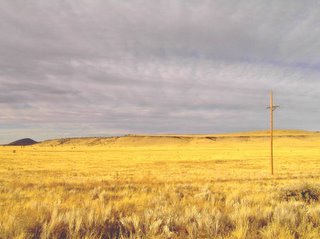
 Left: On the road, heading to Mesa, AZ, from Payson.
Before Highway 87 (the Bumble Bee Highway) rises over the Mazatzal Mtns. from the Tonto Basin, it goes over a spur of the mountain range. In the early 80's (about 1981), when the road was narrower, I got into trouble right here, on the descent of this spur. I tried to pass a semi-truck trailer in my 1970 VW Bug just as the road began its steep descent. The semi wouldn't let me complete passing as we both accelerated downhill, and so I traveled a mile praying that there wasn't any oncoming traffic.
Semis scare me....
 Left: The Big Maria Mtns., just north of Blythe, CA.
Even in the desert, all mountains sport vegetation, but the mountains in the Lower Colorado River Valley have so little vegetation that they begin to approximate the ideal of perfect lunar barrenness.
 Left: The Big Maria Mtns., Lower Colorado River Valley, CA.
 Left: A dust devil lazily spins away the afternoon, hardly travelling at all, but staying essentially in one place, at Dry Lake, in the Eldorado Valley, just south of Boulder City, NV.
 Left: A hillside of Joshua Trees, just north of Lida Junction, NV, on the south-facing slopes of the Goldfield Hills.
The northernmost extent of Joshua Trees along Highway 95 lies between the north-facing slopes of the Goldfield Hills and the south-facing slopes of the San Antonio Mountains, where Tonopah is located.
I find it mysterious that the Joshua Tree demarcation lies between these two ranges of hills. There is no reason I can divine why Joshua Trees, the signature species of the Lower Mojave desert, couldn't spread farther north. Maybe it's a dynamic boundary, and perhaps the only reason Joshua Trees haven't spread farther north is that they just haven't had time to do so yet.
 Left: Brock Mountain, San Antonio Mountains, just SW of Tonopah, NV.
 Left: The wave-cut benches left behind by the high-water mark of now-vanished, ice-age Lake Lahontan are particularly noticeable in the Wassuck Range just northwest of Walker Lake, NV. The wave-cut bench here is the pale horizontal feature just below the picture's middle.
Here, gullies from the hills drape steep alluvial fans over the wave-cut bench. Apparently, sediment-bearing water from the gullies abruptly ran into the calm water of the ancient lake and swiftly dropped its sediment. Now that the lake has vanished, the gully water is now digging into and eroding away the alluvial fans they laid down in a wetter era.
 Left: Wilson Canyon, West Fork of the Walker River, Singatse Range, near Smith, NV.
This is a very pleasant place. The big mystery is why a canyon like this is here in the first place. It's rare that a river chooses to cut right through a mountain range. Perhaps the river predates the mountains and the land is rising swiftly as the river tries to maintain its status quo.
No comments:
Post a Comment