Craig sends this:
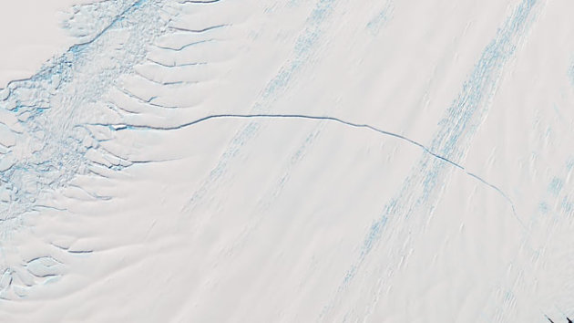
The pencil-thin line across the satellite image of Pine Island Glacier (above) is actually more than 18 miles long, 800 feet across in places, and 180 feet deep.
And it's growing. In the next few months, scientists expect the glacier to create an iceberg about 350 square miles in area. It will probably float northward, melting as it goes.
..."These things happen on a semi-regular basis in both the Arctic and Antarctic, but it's still a fairly large event," said John Sonntag, Instrument Team Lead for Operation IceBridge, in video recorded on the plane.
No comments:
Post a Comment