Boy, there's sure a lot of commotion going on just downstream of the Alameda Bridge across the Rio Grande River. Massive construction associated with the San Juan-Chama Project is underway.
I found a lot of confusion in my own family about what's going on in their own hometown. I suspect this confusion mirrors confusion in the public at large. One of my sisters thought that San Juan water was being carried through pipes to this location, and injected directly into the aquifer there. The other sister suspected a plot (and I paraphrase):
'(Albuquerque Mayor Martin) Chavez promised Intel (which has a large facility located in Rio Rancho) way too much of the city's aquifer water. They suddenly discovered the aquifer doesn't have nearly enough water for the city AND Intel, and now they are panicking.'Plots notwithstanding, some urgency might be in order. If I understand correctly, for years, the City of Albuquerque did not claim its full water rights to San Juan River water, even as water demand exploded elsewhere in the Colorado River Basin (of which the San Juan River is a part), particularly due to the cancerous growth of Las Vegas, withdrawals by the Central Arizona Project (CAP), and other escalating demands in the desert southwest. Use it now, or lose it forever - the Iron Law of the American West when it comes to water!
The official description of the project sounds salubrious enough:
The Albuquerque Bernalillo County Water Utility Authority’s San Juan-Chama Drinking Water Project will supply up to 70% of the metropolitan area’s future water. San Juan-Chama water diverted from the river will be transported to a state-of-the-art treatment plant, from which purified water will be delivered to Albuquerque area homes and businesses.Here is another link regarding the project.
(pictures from December 30 and 31, 2005)
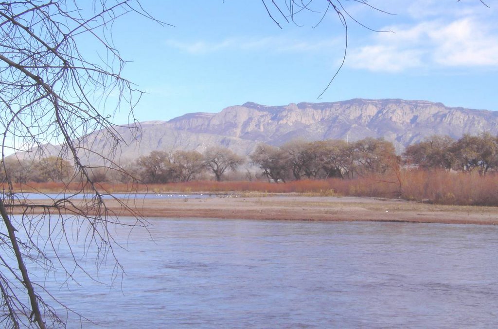 Things are still pretty bucolic in the bosque north of the Alameda Bridge over the Rio Grande River at Albuquerque. By the time I noisily crashed through the dense Russian Olive thickets lining the river, I had frightened off the ducks, and most of the seagulls (the white specks in the photos - it's strange that there are seagulls so far inland in the desert, but the desert river does many mysterious things to bird populations).
 Here is the view looking south from the Alameda Bridge. The San Juan-Chama project occupies about 15 acres in the riverbed and bosque, and comes close today to spanning the entire riverbed. I wanted very much to tour the work site, but it was a work day, and busy workers were everywhere, and so I made do by sneaking downstream through the bosque on the west bank of the river, in order to get a better look.
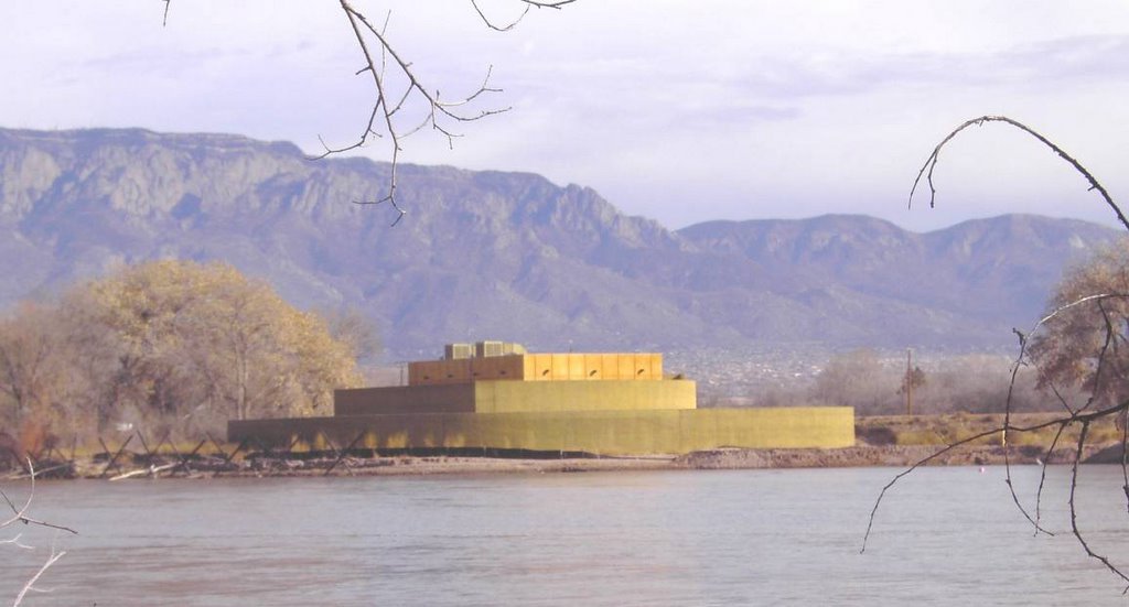 James Bond (and his dog) in the bushes. This mysterious kiva-shaped structure is apparently the municipal surface water treatment plant under construction. Or else, it's a unique, unsuspected, aquatic Anasazi ruin.
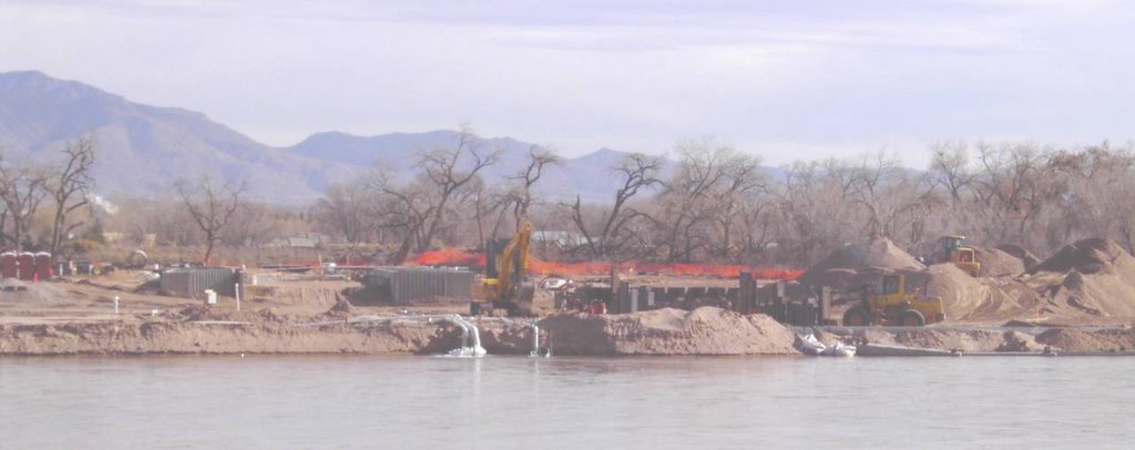 Another surreptitious look at the construction zone. Water was being withdrawn through pipes from the lateral canal on the east side of the river, and some of it was pouring back into the river from pipes, as seen in this photo. Of course, the water in the lateral canal had initially come from the river, and so the exact purpose of all this water shuffling was unclear: kind of like accounting for money. On the left side of the photo appear gray concrete forms that are probably meant for the bladder dam (or is it the coffer dam?) that is supposed to extend across the river.
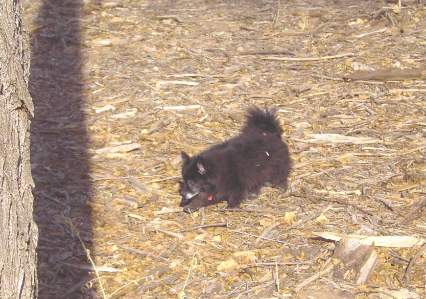 Hopelessly out of his element, Sparky, the city dog from California, doggedly trudges through the bosque in pursuit of his mad master, and tries hard to learn the thrills of being a rural dog.
One interesting thing I noticed is that the four-winged saltbush plant appears to be more plentiful near the river than I ever recall it being before. It did not surprise me that high-desert, salt-loving plants were spreading into the fallow farm fields in the Rio Grande Valley (I had seen that advance when I once lived in Corrales), but their appearance right near the river, together with the generational decline and abrupt burnoff (e.g., the June, 2003 fires) of the old cottonwoods, suggests the region desertifies, if given half the chance by mankind. Is it a trend? Or maybe Mother Nature just wants to restore the area to what it was like before people were there? If it is a trend, in a century, the area will change character, and look a lot more like Socorro, and a lot less like Espanola: Rio Arriba will become Rio Abajo!
Today, the creosote bush that dominates the deserts of southern New Mexico makes it as far north as the hills west of Isleta Pueblo, only fifteen miles or so from this location. Cresote bush is a key plant species: how far north will it reach in a century? Will it make it to Albuquerque? What stops its northern advance - temperature, water, or competition?
No comments:
Post a Comment