
Rolling towards the runway at Lindbergh Field in San Diego.

Waiting for other planes to land before we take off.

Waiting for other planes to land before we take off.

Airport terminal, Pt. Loma, and San Diego Bay.

Pt. Loma, heading west.

Turned around, and heading east.

Pt. Loma, and Coronado peninsula.

8

Interstate 8 and the big crest above the Colorado Desert.

Various wind-turbine pads.

Salton Sea.

New River.

Salton Sea and New River.

Southern reaches of the Colorado River, just north of the Mexican border.

Farming in southwestern Arizona.

Gila Bend.

Western reaches of the Phoenix area.

18

Interstate 17 corridor in urban Phoenix.

NE side of Phoenix.

Northern side of Scottsdale.

Verde River.

Apache Reservoir.

24

25

Mesas traversed by Coronado in 1540, near the Rio Vermejo, according to Nugent Brasher.

Mesas traversed by Coronado in 1540, near the Rio Vermejo, according to Nugent Brasher.

28

29

30

Southern reaches of the Laguna Reservation, New Mexico.

Where Highway 6 approaches Interstate 40.

Rio Puerco.

Crest between Rio Puerco & Rio Grande watersheds.

Atrisco Vista Blvd.

36

37

Rinconada Canyon, Petroglyph National Monument.

Coors Blvd., looking north.

Bluffs along west side of the Rio Grande River.

Interstate 25, and the Sandia Mountains.

Sandia Mountains, Bear Canyon Arroyo, and Montgomery Blvd.

Menaul Blvd.

Interstate 40.

Sandia Base.

Lovelace-Gibson Hospital, foreground; U.S. Veteran's Hospital background.
 Rolling towards the runway at Lindbergh Field in San Diego.
 Waiting for other planes to land before we take off.
 Waiting for other planes to land before we take off.
  Airport terminal, Pt. Loma, and San Diego Bay.
 Pt. Loma, heading west.
  Turned around, and heading east.
  Pt. Loma, and Coronado peninsula.
  8
8  Interstate 8 and the big crest above the Colorado Desert.
  Various wind-turbine pads.
  Salton Sea.
  New River.
  Salton Sea and New River.
  Southern reaches of the Colorado River, just north of the Mexican border.
  Farming in southwestern Arizona.
  Gila Bend.
  Western reaches of the Phoenix area.
  18
18 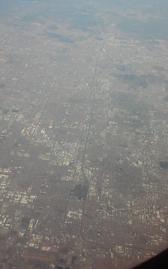 Interstate 17 corridor in urban Phoenix.
  NE side of Phoenix.
  Northern side of Scottsdale.
  Verde River.
  Apache Reservoir.
  24
24  25
25  Mesas traversed by Coronado in 1540, near the Rio Vermejo, according to Nugent Brasher.
  Mesas traversed by Coronado in 1540, near the Rio Vermejo, according to Nugent Brasher.
  28
28  29
29  30
30  Southern reaches of the Laguna Reservation, New Mexico.
  Where Highway 6 approaches Interstate 40.
  Rio Puerco.
  Crest between Rio Puerco & Rio Grande watersheds.
  Atrisco Vista Blvd.
  36
36  37
37  Rinconada Canyon, Petroglyph National Monument.
  Coors Blvd., looking north.
  Bluffs along west side of the Rio Grande River.
  Interstate 25, and the Sandia Mountains.
  Sandia Mountains, Bear Canyon Arroyo, and Montgomery Blvd.
  Menaul Blvd.
  Interstate 40.
  Sandia Base.
  Lovelace-Gibson Hospital, foreground; U.S. Veteran's Hospital background.
No comments:
Post a Comment