 Southwestern Air Quality
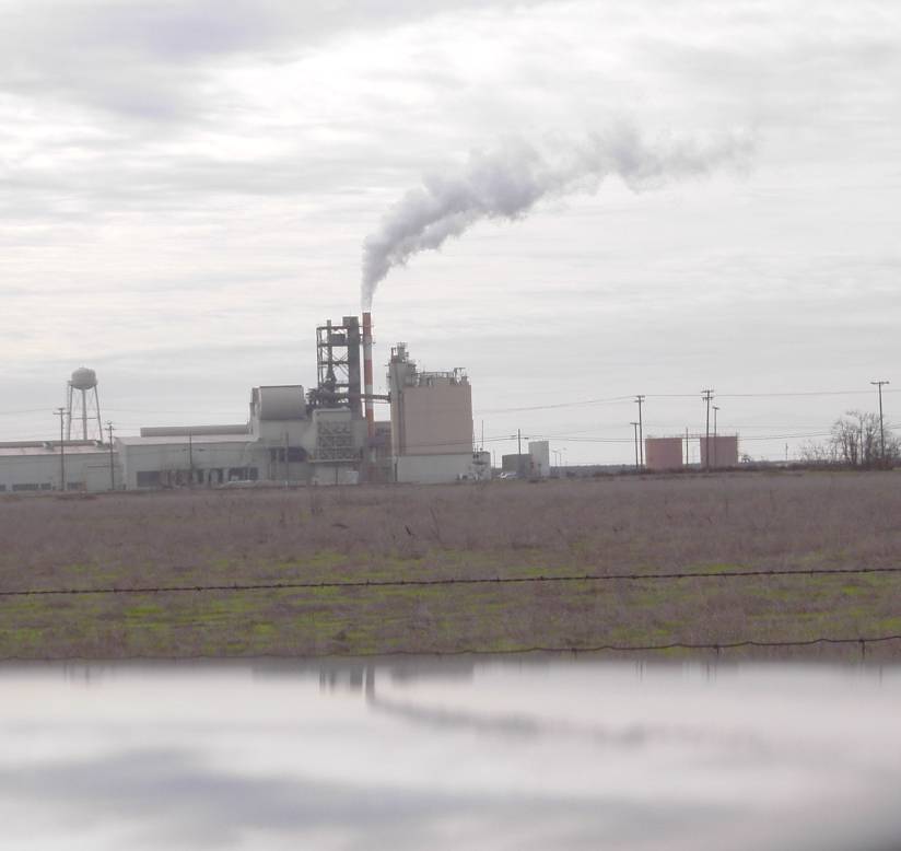
Here is a combustion plume containing a beaucoup amount of water vapor (December 27, 2005). I used to model these kinds of plumes. The remarkable thing about this plume is its high exit velocity, plus its strong visual definition. This facility is in the Central Valley of California, in Madera County, near the town of Fairmead (apparently not far from a prison).
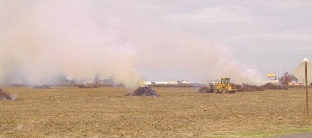 Agricultural burning in the fields just north of Fowler, California (December 27, 2005, in Fresno County, California, a short distance south of the City of Fresno.)
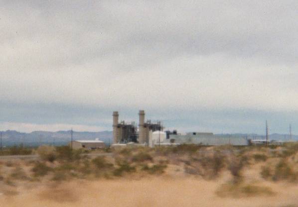 These are two turbines at Griffith, AZ, a few miles SW of Kingman. I had done preliminary modeling for this facility, but had lost touch with it, and so it was kind of a surprise to see it, large as life, sitting beside I-40.
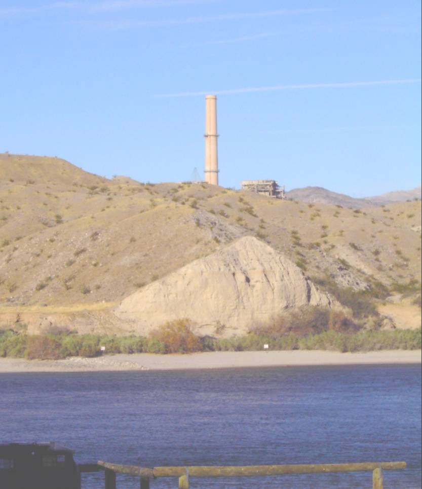 Vanishing forever? The Mohave Generating Station's Laughlin stack, behind a hill, as seen from across the Colorado River, in Bullhead City, AZ (January 5, 2006).
One big surprise of the trip was discovering that the coal-fired Mohave Generating Station at Laughlin, NV is to be shut down soon. The facility operators decided to close the place rather than install expensive new sulfur dioxide scrubbers.
The power plant closure will undoubtedly help clean the air in the Grand Canyon area and lower Colorado River Valley. In addition, the water-grabbing slurry pipeline will be shut down. Nevertheless, there's a significant price. Apparently the Mohave Generating Station is the only current customer of the Black Mesa Mine, on the Navajo Reservation, and so that mine will be closed too. As far as I can tell, the Kayenta Mine will remain open, however, to fuel the power plant at Page, AZ, and also the Four Corners Power Plant in NM, among others.
The mine closure will be an economic calamity on the Navajo Reservation, not only because of the jobs involved, but because the Peabody Western Coal Co. was helping support water utilities, as well as Internet access for schools, on the reservation. Huge craters have appeared in reservation government budgets.
But of course, if the price of natural gas keeps rising, maybe the plant will become economically-viable once more, the price of scrubbers be damned!
On January 5th, I watched a dust storm initiate among farm fields on the Mohave Indian Reservation, between Needles, CA, and Laughlin, NV, while driving south towards Needles. The wind was blowing just strong enough to start some dust saltating on bare ground in the Colorado River Valley. Dust levels remained low elsewhere in the desert, where there was enough ground cover to limit the evolution of dust plumes.
Some of the dust was coming from bare new home sites, and some was coming from bare areas where salt cedar had recently been chained, and some dust was coming from bare, plowed, fallow fields, but by far, most of the dust was coming from the edges of active IRRIGATED fields. Green grass kept dust coming from 95% of the land area of the irrigated fields, but that extra, bare 5% of the land area dedicated to access roads, pumping stations, and field borders was rough enough (rougher than the bare plowed fields) to completely dominate dust generation for the entire area. Even bare plowed fields couldn't compete in generating the same amounts of dust as the irrigated fields. Quite a counter-intuitive surprise, but I'm sure windblown dust experts like Dr. Dale Gillette would understand!
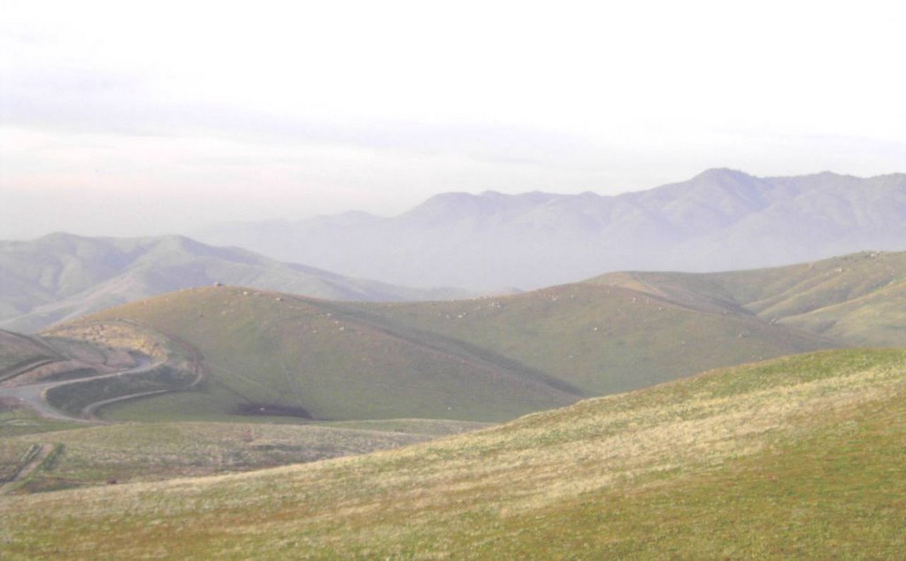 Here's a view the Joad family from John Steinbeck's "The Grapes of Wrath" might have recognized: the Promised Land, the Central Valley of California! Descending into the Central Valley from the heights of the Tehachapi Mountains (January 5, 2006).
Returning to California, the surface air in the whole Central Valley was filled with fine particulate matter, almost like a white smoke. It's about the right time and place: I wonder if ammonium nitrate generation had gone hog wild, like it sometimes does in California in the winter?
No comments:
Post a Comment