
Wednesday, August 19, 2015
Breaking Bad - The Superlab Environment (UE4)
Marius Laurentiu posted this the other day. I just wanted to re-emphasize how masterfully-real Unreal Engine 4 is, and what a great addition this is to Petrauskas' masterfully-real Breaking Bad Cabin video!
Chandra Asks About El Niño
Chandra asks:
NOAA NWS Climate Prediction Center announces:
 The Niño-3.4 region is a place; the closest strip of ocean water along the Equator most likely to affect us (southwest of us; southeast of Hawaii). Surface waters there are 2 degrees Centigrade warmer than usual, which is an unusual state of affairs that we haven't seen since 1997. There's also no indication El Niño will go away before winter. Warm water provides an unusually-rich source of atmospheric moisture. Whether the weather can tap that moisture for us is still unclear, since we are so far from the Equator. Usually it means lots of rain, but not always. The illustration shows results of the winters of 1982-3 on the left (wet) and 1965-6 on the right (dry), both strong El Niño years. The rest of the atmosphere will have to respond favorably to help us.
My own sense is that we've seen a strip of drought move west across the U.S. for the last eight years, first affecting the American South (2006-8), then Texas (2010-11), then the Southwest (2012-13), then California (2014-15). It's now incorporating the Pacific Northwest (2015-?) as it continues its march west. My guess is that the Pacific Northwest will continue to be dry this winter, but drought will end in southern California. The most well-known climatologist in southern California, Bill Patzert at JPL, worries there could be floods in SoCal and continued drought in NorCal. His nightmare is a possibility!
If rains are to come, something will have to kill the Really Resilient Ridge that has bedeviled California since January, 2013. Interestingly, long-range, 2-week weather forecasts show a combination of powerful storms in Alaska and the northwest Pacific will create an Aleutian low that will kick the ridge west starting on August 28th, opening the possibility of some rain in NorCal as soon as September 7th. If so, that would be really early! I'm hoping that we'll know what lies in store for us fairly early.
Can you give your expert opinion, in 8th grade terms??? lol!!!! I lived in the mountains during the last real el nino and O boy!!! So this really interests me!!!
NOAA NWS Climate Prediction Center announces:
Ha! I had to look things up (SST means 'sea surface temperature': OI means nothing at all, as far as I can tell, so no wonder it's confusing).
The latest ENSO diagnostic discussion was released last Thursday, and highlighted the unanimous forecaster consensus for a strong El Niño event continuing into the winter. The latest weekly OI SST anomaly value in Niño 3.4 is +2.0C!

My own sense is that we've seen a strip of drought move west across the U.S. for the last eight years, first affecting the American South (2006-8), then Texas (2010-11), then the Southwest (2012-13), then California (2014-15). It's now incorporating the Pacific Northwest (2015-?) as it continues its march west. My guess is that the Pacific Northwest will continue to be dry this winter, but drought will end in southern California. The most well-known climatologist in southern California, Bill Patzert at JPL, worries there could be floods in SoCal and continued drought in NorCal. His nightmare is a possibility!
If rains are to come, something will have to kill the Really Resilient Ridge that has bedeviled California since January, 2013. Interestingly, long-range, 2-week weather forecasts show a combination of powerful storms in Alaska and the northwest Pacific will create an Aleutian low that will kick the ridge west starting on August 28th, opening the possibility of some rain in NorCal as soon as September 7th. If so, that would be really early! I'm hoping that we'll know what lies in store for us fairly early.


Important To Keep The Squirrels In The Trees
That's one embarrassed-looking squirrel! Uncontrolled fall from a tree onto an ivy-covered fence. Total loss of squirrel gravitas there.
The Interviewer Won't Stop Prattling On About Dido
This interview regarding Dido was my favorite part of the haunting, recently-released movie "Amy". Given any subject, I spend most of my life in this same, exact frame of mind! Amy Winehouse's facial expressions are so precious!
Just Love The Vitajex Sequence!
On August 16th, TCM showed "A Face In The Crowd", the 1957 movie that made Andy Griffith a star and also starred Walter Matthau and Lee Remick. Years before movies like "Network", Elia Kazan and company were prophets! Just look at the disaster of FOX News!
Saturday, August 15, 2015


Flight From Albuquerque To Phoenix, Then On To Sacramento - Phoenix-Area Portion - August 3, 2015
 Rio Verde.
 Bartlett Lake.
 Fountain at Fountain Hills.
 Fountain at Fountain Hills.
 Beeline Highway.
 Red Mountain Freeway and North Alma School Rd.
 McDowell and Beeline Triple Junction.
 Pima Freeway - Scottsdale Boundary.
 Near N. Hayden and E. McKellips Rd.
 McKellips Lake.
 Priest Dr. and Washington St./ Papago Park Center.
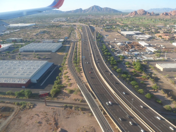 I-10.
I-10. Sky Harbor.
 Sky Harbor.
 Sky Harbor.
 Sky Harbor.
 Sky Harbor.
 I-10.
I-10. Downtown Phoenix.
 North Central.
 Near Black Canyon Freeway and W. Carefree Highway/ AZ Game and Fish headquarters.
 Through the murk, and after sunset, Lake Tahoe.
Friday, August 14, 2015
Flight From Albuquerque To Phoenix - NM Leg - August 3, 2015
 Albuquerque International Sunport.
 I've never seen the hill at Tome (Belen?) and the Ladron Mountains line up so well before, but that's probably because you have to be nearly at the intersection of the two runways to see it so well.
 Rio Bravo Blvd. and I-25 interchange.
 SW of the South Valley tank farm.
 Second St. and the railroad.
 Sandia Mountains.
 Rio Grande River and Bridge Blvd.
 Rio Grande River and Bridge Blvd.
 Rio Grande High School.
 Master-planned development on the city's southwest side.
 Curious, this West Mesa terrain.
 I-40 and Central Ave.
 KOAT TV Doppler radar.
 The crest between the Rio Grande and Rio Puerco watersheds.
 The Rio Puerco River.
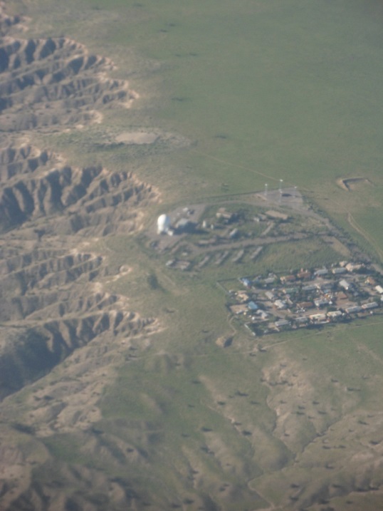
 Approaching To'hajiilee. Canada de los Apaches.
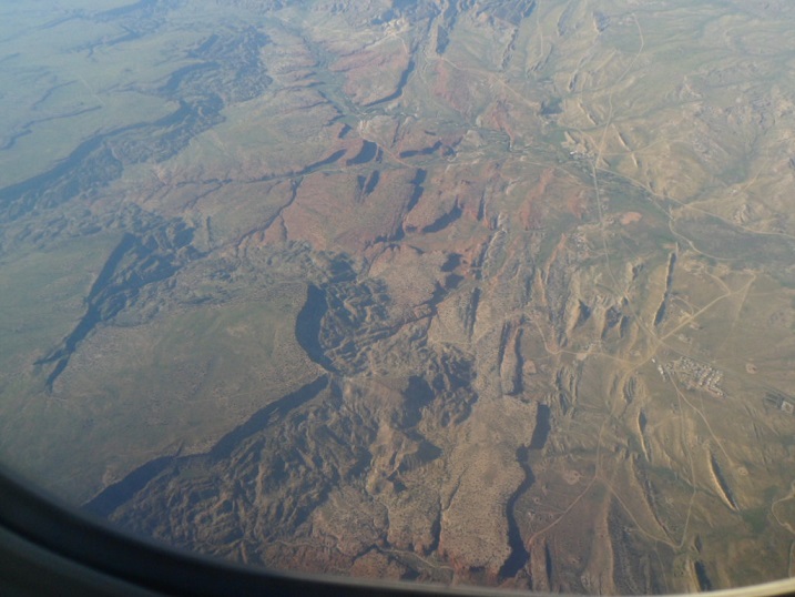 To'hajiilee. Sandoval Canyon and Mesa Gigante.
 To'hajiilee. Sandoval Canyon and Mesa Gigante.
 To'hajiilee. Sandoval Canyon and Mesa Gigante.
 To'hajiilee. Sandoval Canyon and Mesa Gigante.
 Cerro de la Celosa, Moquino, Seboyeta, Bibo, Paguate.
 Flank of Mt. Taylor: Wheat Mountain, lava flows.
 Flank of Mt. Taylor: New Laguna, lava flows.
 Flank of Mt. Taylor: Encinal Canyon, Paraje Mesa, lava flows.
 Flank of Mt. Taylor, looking ENE. Lava flows.
 Entire southern flank of Mt. Taylor.
 Near Cubero. Paraje Mesa; looking ENE.
 The distant, magical-looking Cerro Alesna. I need to go there some day.
 Acomita Lake/ Skyline-Ganipa.
 McCartys. Horace Mesa, Tafoya Canyon.
 Mt. Taylor.
 Between McCartys and Grants. Horace Mesa, McCarty Mesa, McCarty.
 Along State Road 117. Las Ventanas Ridge, El Malpais.
 Bonita Canyon, Gallo Peak, San Rafael Mesa.
 Mine on State Road 53, near Tinaja.
 Mine on State Road 53, near Tinaja.
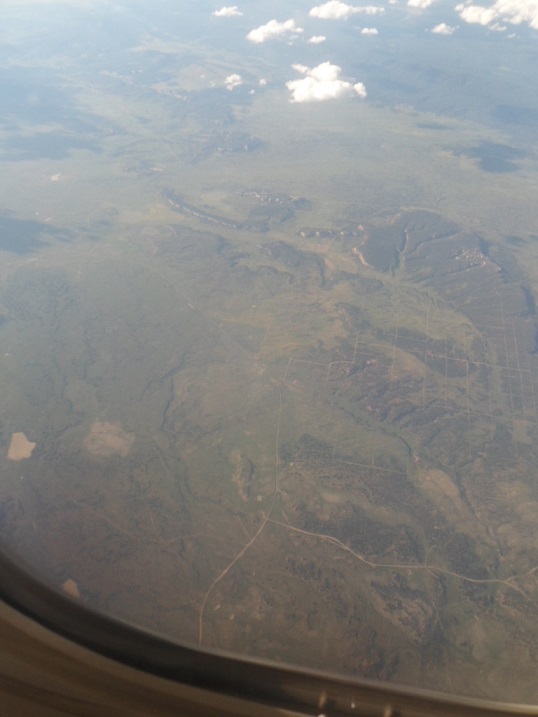 South of El Morro Rock. Ramah Navajo Indian Reservation.
 Southwest of El Morro Rock; El Morro. Ramah Navajo Indian Reservation.
 North of Pine Hill. Ramah Navajo Indian Reservation.
 State Roads 36 at McKinley County Line.
 Southeast of Zuni.
 Dowa Yalane, near Zuni. The residents of Zuni fled here when Coronado came to this area in 1540.
 Ojo Caliente Reservoir.
Subscribe to:
Comments (Atom)