Saturday, September 02, 2017

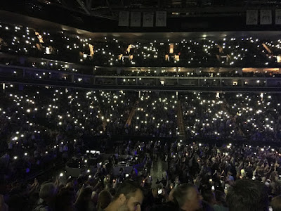
Tom Petty Concert - Golden One Center - Sacramento, CA - September 1, 2017


Through a completely-unexpected series of events, we got a pair of free tickets to the Tom Petty concert. (A friend of Pam Kay Lourentzos bought the tickets, but couldn't attend. She handed the tickets to Pam, and Pam gave them to me. So, I asked Carolyn Gregory to go.

But first, dinner at Rio City Cafe in Old Sacramento on the shores of the Sacramento River.


Golden One Arena in the light of sunset.


Opening Act, "The Shelters."


Encore.


Tom Andrews' Retirement - Sierra Research - Aioli Restaurant - Aug. 30, 2017

Friday, September 01, 2017

Janik & Arnaut Snake Dance

College Days: Cinderella City

I remember Englewood, Colorado's Cinderella City from 1976, when it was the largest mall west of the Mississippi. It's still incomprehensible to me how quickly malls declined. They were particularly vulnerable to trade policies that shipped high wage jobs overseas.

Mr. Rogers and Early Electronic Music

What the Journalists Call a "Kinsley Gaffe"

Stories From College Days

I've been writing a memoir of college days. Hard to write some of these stories - they strike a little too close to home sometimes.

Here's one story of when I was working at the Air Force Weapons Lab (AFWL) at Kirtland Air Force Base (AFB) in Albuquerque, circa 1978:

In order to reach the AFWL, we’d have to pass through one of the Kirtland AFB guard posts, typically the one on Carlisle Blvd. I remember one day, waiting second-in-line in my VW Bug as the guard talked to the driver of a camper vehicle in front of me.

To my surprise, there was a small boy in the back of the camper vehicle. He would wave his hand out the back window, duck, hide, and then reappear to wave again. He was so cute! I scrunched down behind my steering wheel, held my hand close to my face, flapped my fingers with a tiny, vigorous motion, and ducked as well. We played our little hide-and-seek game as the adult conversation dragged on.

Suddenly, the camper vehicle pulled away. The little boy reappeared and waved as the vehicle drove away. I continued scrunching down behind my steering wheel, holding my hand close to my face and flapping my fingers vigorously as the camper receded into the distance.

Snap back to reality. The guard was attentively watching me, apropos of nothing, scrunching down behind my steering wheel and flapping my fingers close to my face. He walked out and authoritatively stood in front of my vehicle, hands on hips. He looked around, abruptly bent his knees, scrunched down, and by holding his hand very close to his face, waved me through with the tiniest of waves.

Beaumont/Port Arthur Really Got It Too

Wow!:
On Tuesday alone, Beaumont-Port Arthur registered 26.03 inches of rain — including a foot of rain which poured down in just six hours. The 26-plus inches doubled its record for previous wettest day (12.76 inches from May 19, 1923) and even exceeded the most rain in any previous month on record.

Rainfall totals since Friday in the Beaumont-Port Arthur area ballooned to 47.7 inches pushing its annual rainfall to nearly 87 inches – a new record, with one-third of the year still to go.

Wednesday, August 30, 2017

And a Remarkably Similar Story in India

Flooding:
Extreme rainfall has led to devastating floods across Nepal, India, and Bangladesh, killing nearly 1,200 people and displacing millions.

People Need To Stop Yelling at Houston

I have many issues with Texan political culture, but on this specific matter, the stay-at-home people have been the more realistic than the folks urging immediate evacuation.

But now that the storm has passed, the hard work can start, and a more-specific, more-realistic evacuation can commence. Big parts of Houston have been rendered unlivable, or certainly dodgy. Repairing the torn fabric of the city will be hard work:
Houstonians who didn't evacuate aren't stupid, or arrogant, or naive. They didn't have their heads in the sand and they didn't ignore the weather predictions. They're people with a better sense of what's involved in a major evacuation, and what could possibly go wrong, than most of the people in this country. Stop second-guessing their mayor, stop shaking your head at "those people" and mocking them for needing to be plucked off their rooftops by helicopters.

Help them.

Highest Rainfall Totals From Harvey

Some of the highest rainfall totals (inches) from Harvey:

...TEXAS...
CEDAR BAYOU AT FM 1942 51.88
CLEAR CREEK AT I-45 49.40
MARYS CREEK AT WINDING ROAD 49.20
DAYTON 0.2 E 46.08
HORSEPEN CREEK AT BAY AREA BLVD 45.60

Tuesday, August 29, 2017

Coming: DMTC's "Jekyll and Hyde"

Rehearsals have been awesome! The show will be even more awesome!

A Destructive Kind of Cunning


The dodgy behavior I saw with Harvey this afternoon ended with sunset, but there's no assurance it won't happen tomorrow too. I think Harvey was using Houston's afternoon heat to try and make itself much more compact and efficient. Had there been assisting factors, like the presence of an inland, upwind range of hills or mountains (something like you see in Australia), it might have even succeeded. There's almost a destructive kind of cunning about this storm.

The Harris County Flood Control District has a map on their website posting rainfall data for its gauges. Here is rainfall over the past week (which is a little longer than, and thus contains more, than the storm total). There are a few places with more than 40 inches - more than a meter - of rain in a week. These rainfall totals are highly-unusual, and perhaps record-breaking.

Insurers and the federal government have reason to revisit Houston-area flood risk assessment and adjust rates accordingly. According to an article in Slate:
"This is the third straight year that Houston has endured a devastating, once-in-a-lifetime flood. There were the Memorial Day floods in 2015 and the Tax Day floods in 2016. Together the storms killed 16 people and caused more than $1 billion in damage. More than a third of the properties that flooded in Houston’s 2015 Memorial Day floods were located outside the “hundred-year floodplain,” the zone in which FEMA requires homeowners with government-backed mortgages to elevate homes or buy flood insurance. Now with Harvey, Houston has been hit with six “hundred-year storms” since 1989."

And heavy rains continue in southeast Texas....

Monday, August 28, 2017

Hot Day Today in California's Central Valley

From the National Weather Service:

RECORD EVENT REPORT...AMENDED TO INCLUDE DOWNTOWN SACRAMENTO

NATIONAL WEATHER SERVICE SACRAMENTO, CA
1023 PM PDT MON AUG 28 2017

...MULTIPLE RECORD HIGH TEMPERATURES SET IN CENTRAL VALLEY TODAY...

A RECORD HIGH TEMPERATURE OF 110 DEGREES WAS SET AT REDDING AIRPORT CA TODAY. THIS BREAKS THE OLD RECORD OF 109 SET IN 2008.

A RECORD HIGH TEMPERATURE OF 110 DEGREES WAS SET AT SACRAMENTO EXEC. AIRPORT CA TODAY. THIS BREAKS THE OLD RECORD OF 104 SET IN 2008.

A RECORD HIGH TEMPERATURE OF 112 DEGREES WAS SET AT STOCKTON AIRPORT CA TODAY. THIS BREAKS THE OLD RECORD OF 106 SET IN 1981.

A RECORD HIGH TEMPERATURE OF 109 DEGREES WAS SET AT MODESTO CA TODAY. THIS BREAKS THE OLD RECORD OF 105 SET IN 2015.

A RECORD HIGH TEMPERATURE OF 109 DEGREES WAS SET AT DOWNTOWN SACRAMENTO CA TODAY. THIS BREAKS THE OLD RECORD OF 105 SET IN 1915.

Harvey is Trying to Wind Up Again.

I think that Harvey is trying to wind up again. Radar shows suspicious circular movement on land just SW of Houston. National Hurricane Center shows winds are increasing to 45 kt. Normally land is a bad place to wind up, but every surface is wet, and land has a lower heat capacity than water, so it will do, especially in the afternoon sun. Meanwhile, rains fall and fall in Houston.

Sunday, August 27, 2017

Things Could be Worse

The center of Harvey's circulation is just east of Victoria, Texas, and will likely glide offshore into the Gulf of Mexico sometime tonight. In the normal course of events, it would restrengthen into a hurricane, but it's so close to the shore it probably doesn't have enough time to fully wind up. Indications are it will come ashore again somewhere east of Lake Charles, Louisiana, Wednesday night, August 30th, and take away the heaviest rains from SE Texas.

Caught in the Jaws of a Death Machine

This isn't going to turn out well. The full calamity forecasters worried about may come to pass. Late last night, the storm began inching its way back to the Gulf. The broadened, asymmetrical storm now has access to moisture again. It is softening up the Houston area and the SE Texas coast with relentless rain, and once it has a chance to strengthen, then it will make a second landfall and go for the kill: right now, it looks like around Port Arthur on Wednesday evening, August 30th.

Houston Hobby Airport storm total is over 12" so far, but some storm totals in the area are reaching 22", and higher. It's too dangerous to travel, but it may be to dangerous to stay. Not good.