Saturday, January 07, 2006
Signs
Like The Five Man Electrical Band sang:
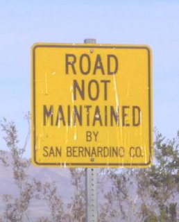 What does this sign mean exactly? It's located at the I-40 freeway stop of Ludlow, CA, in the middle of the Mojave Desert. It's not exactly a warning, but more like official announcement, absolving governmental responsibility for your wretched fate on hazardous desert back roads. Caveat driver!
This sign is like the box downstairs at work, labelled "do not place unstamped mail in this box" (implying that just about anything else, from elephants to transaxles, can be placed in the box).
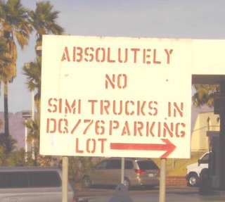 Do what you are told! (also at Ludlow, CA).
 Graffiti under the I-10 bridge over the Colorado River, at Blythe, CA.
 I guess people have a lot of aggression to work out in Arizona! This place is located very near where I once lived, in Tempe. Maybe it's better I left when I did!
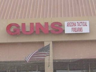 Dammit, I was looking for strategic firearms! I guess I have to go to the mall instead!
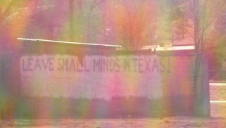 A sign of strident discontent, on a wall in Magdalena, NM.
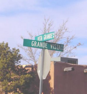 This is one of Walt's favorite intersections in Albuquerque (on the West Mesa).
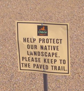 The irony of this sign, of course, is that the exclusive, gated Oxbow residential development, hugging the bluffs just below St. Pius X High School (the former St. Joseph's College, AKA University of Albuquerque), on the West Mesa of Albuquerque, wiped out native plants that we monitored during a special summer high school biology workshop, taught by Mr. Funk and Mr. Templeton, in 1973. Damn those Oxbow bastards!
Link
Like The Five Man Electrical Band sang:
And the sign said,Lots of interesting signs on this southwestern trip! There were fun road signs like Sandy Mush Road, in the Central Valley, or the ever-popular Zzyzzyx Road exit, between Barstow and Las Vegas. Or curious informational signs, like "70' Public Scale," or the "Living Water Bible Church." Some signs were schizophrenic, like "T&T Liberty Safes" in the Central Valley (safes and liberty don't go together!)
"Long-haired freaky people
Need not apply."
So I tucked my hair up under my hat
And I went in to ask him why.
He said, "You look like a fine upstandin' young man.
I think you'll do."
So I took off my hat and said, "Imagine that.
huh , me workin' for you."
Whoa, sign, sign.
Everywhere a sign.
Blockin' out the scen'ry.
Breakin' my mind.
Do this. Don't do that.
Can't you read the sign?
 What does this sign mean exactly? It's located at the I-40 freeway stop of Ludlow, CA, in the middle of the Mojave Desert. It's not exactly a warning, but more like official announcement, absolving governmental responsibility for your wretched fate on hazardous desert back roads. Caveat driver!
This sign is like the box downstairs at work, labelled "do not place unstamped mail in this box" (implying that just about anything else, from elephants to transaxles, can be placed in the box).
 Do what you are told! (also at Ludlow, CA).
 Graffiti under the I-10 bridge over the Colorado River, at Blythe, CA.
 I guess people have a lot of aggression to work out in Arizona! This place is located very near where I once lived, in Tempe. Maybe it's better I left when I did!
 Dammit, I was looking for strategic firearms! I guess I have to go to the mall instead!
 A sign of strident discontent, on a wall in Magdalena, NM.
 This is one of Walt's favorite intersections in Albuquerque (on the West Mesa).
 The irony of this sign, of course, is that the exclusive, gated Oxbow residential development, hugging the bluffs just below St. Pius X High School (the former St. Joseph's College, AKA University of Albuquerque), on the West Mesa of Albuquerque, wiped out native plants that we monitored during a special summer high school biology workshop, taught by Mr. Funk and Mr. Templeton, in 1973. Damn those Oxbow bastards!
Link
"Joseph And The Amazing Technicolor Dreamcoat" at DMTC
 (second draft of list)
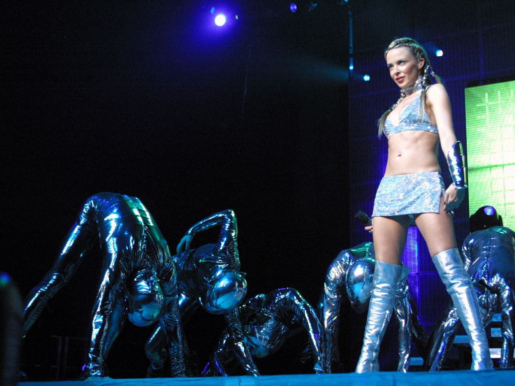
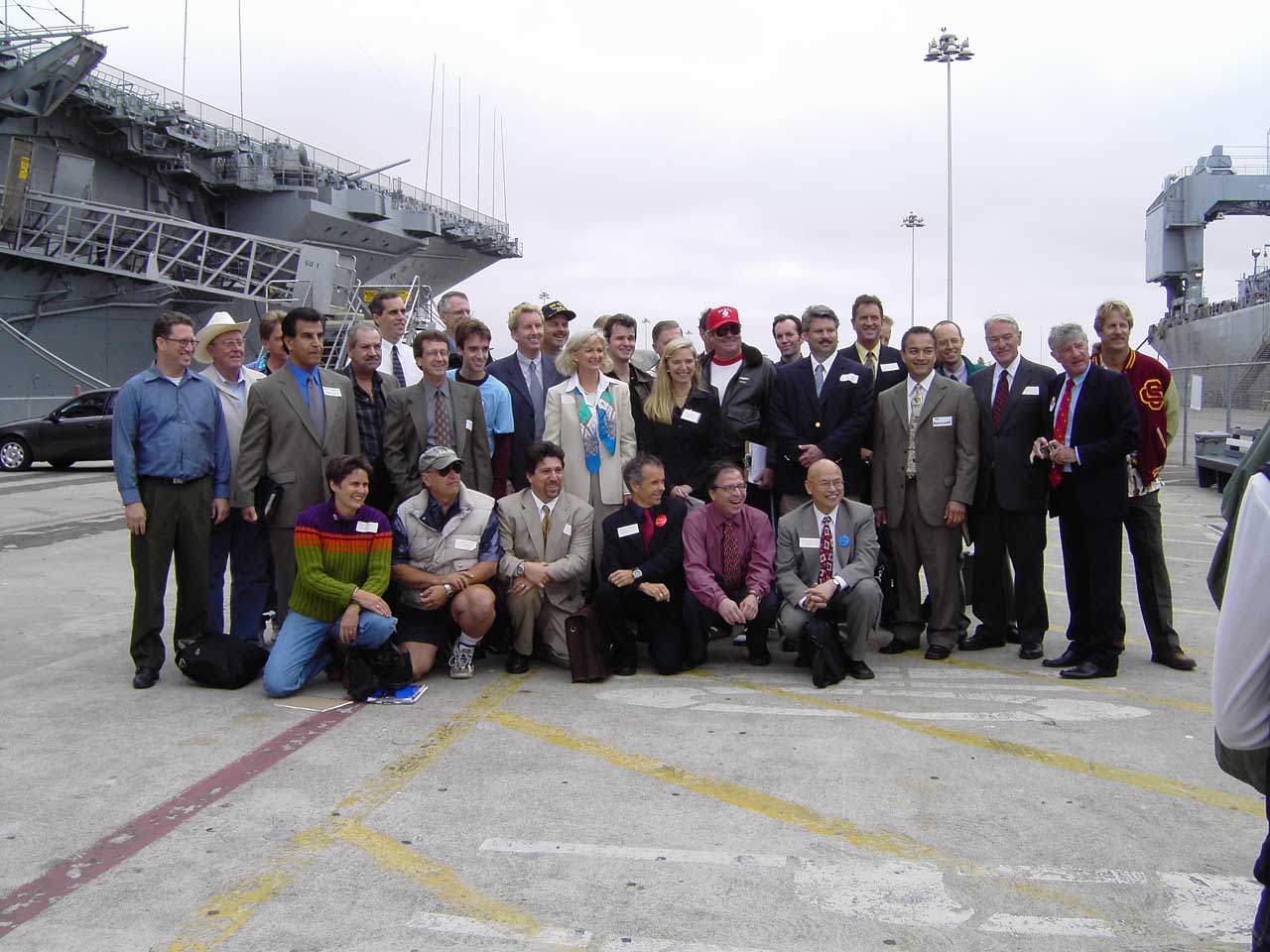
Final Bows: Center - Andrea Eve Thorpe (Narrator) and Ryan Adame (Joseph). Kneeling children, left to right, audience left: Meghan Vanderford, Cass Olson, Lisa Parente, Kaylynn Rothleder. Audience right: Andrew and Linnea Lampinen, Sara Pinto, Rebecca Rudy, Rachel Pinto. Women standing, audience left: Bridget Maguire, Heather Sheridan, Debbie Vanderford, Helen and Julia Spangler, Dian Hoel. Mostly women standing, audience right: Julia and Rich Kulmann, Kris Farhood, Marisa Casillas, Jan Isaacson, Maria Ramirez. Men standing in rear, audience left: Michael Miiller, Chris Danti, Asaad Kevel, J.P. Villa. Men standing, audience right: Jabriel Shelton, Craig Meyers, Robert Coverdell, Tom Hansen, Mike Jones, Joey Lemons. Out of picture, to audience right: Alex Stewart.
I saw Act II on Friday night, January 7th at the Hoblit Performing Arts Center (official opening night, excluding the New Year's Eve preview). We've rarely had better sets, and I don't think we've ever had better costumes! Microphone problems marred some of the songs, and I think the pace dragged slightly, but there are plenty of funny and creative bits: director Michael Miiller has done an excellent job! I will have to get around to seeing Act I soon!
 Handsome stage!
 (second draft of list)
Final Bows: Center - Andrea Eve Thorpe (Narrator) and Ryan Adame (Joseph). Kneeling children, left to right, audience left: Meghan Vanderford, Cass Olson, Lisa Parente, Kaylynn Rothleder. Audience right: Andrew and Linnea Lampinen, Sara Pinto, Rebecca Rudy, Rachel Pinto. Women standing, audience left: Bridget Maguire, Heather Sheridan, Debbie Vanderford, Helen and Julia Spangler, Dian Hoel. Mostly women standing, audience right: Julia and Rich Kulmann, Kris Farhood, Marisa Casillas, Jan Isaacson, Maria Ramirez. Men standing in rear, audience left: Michael Miiller, Chris Danti, Asaad Kevel, J.P. Villa. Men standing, audience right: Jabriel Shelton, Craig Meyers, Robert Coverdell, Tom Hansen, Mike Jones, Joey Lemons. Out of picture, to audience right: Alex Stewart.
I saw Act II on Friday night, January 7th at the Hoblit Performing Arts Center (official opening night, excluding the New Year's Eve preview). We've rarely had better sets, and I don't think we've ever had better costumes! Microphone problems marred some of the songs, and I think the pace dragged slightly, but there are plenty of funny and creative bits: director Michael Miiller has done an excellent job! I will have to get around to seeing Act I soon!
 Handsome stage!
Friday, January 06, 2006
Artist In The Desert
Sounds like performance art, but apparently it's an accident:
Link
Sounds like performance art, but apparently it's an accident:
An artist who chained his legs together to draw a picture of the image hopped 12 hours through the desert after realizing he lost the key and couldn't unlock the restraints, authorities said Wednesday.
Link
 Southwestern Air Quality
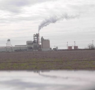
Here is a combustion plume containing a beaucoup amount of water vapor (December 27, 2005). I used to model these kinds of plumes. The remarkable thing about this plume is its high exit velocity, plus its strong visual definition. This facility is in the Central Valley of California, in Madera County, near the town of Fairmead (apparently not far from a prison).
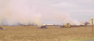 Agricultural burning in the fields just north of Fowler, California (December 27, 2005, in Fresno County, California, a short distance south of the City of Fresno.)
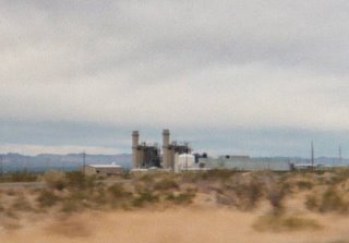 These are two turbines at Griffith, AZ, a few miles SW of Kingman. I had done preliminary modeling for this facility, but had lost touch with it, and so it was kind of a surprise to see it, large as life, sitting beside I-40.
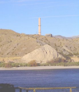 Vanishing forever? The Mohave Generating Station's Laughlin stack, behind a hill, as seen from across the Colorado River, in Bullhead City, AZ (January 5, 2006).
One big surprise of the trip was discovering that the coal-fired Mohave Generating Station at Laughlin, NV is to be shut down soon. The facility operators decided to close the place rather than install expensive new sulfur dioxide scrubbers.
The power plant closure will undoubtedly help clean the air in the Grand Canyon area and lower Colorado River Valley. In addition, the water-grabbing slurry pipeline will be shut down. Nevertheless, there's a significant price. Apparently the Mohave Generating Station is the only current customer of the Black Mesa Mine, on the Navajo Reservation, and so that mine will be closed too. As far as I can tell, the Kayenta Mine will remain open, however, to fuel the power plant at Page, AZ, and also the Four Corners Power Plant in NM, among others.
The mine closure will be an economic calamity on the Navajo Reservation, not only because of the jobs involved, but because the Peabody Western Coal Co. was helping support water utilities, as well as Internet access for schools, on the reservation. Huge craters have appeared in reservation government budgets.
But of course, if the price of natural gas keeps rising, maybe the plant will become economically-viable once more, the price of scrubbers be damned!
On January 5th, I watched a dust storm initiate among farm fields on the Mohave Indian Reservation, between Needles, CA, and Laughlin, NV, while driving south towards Needles. The wind was blowing just strong enough to start some dust saltating on bare ground in the Colorado River Valley. Dust levels remained low elsewhere in the desert, where there was enough ground cover to limit the evolution of dust plumes.
Some of the dust was coming from bare new home sites, and some was coming from bare areas where salt cedar had recently been chained, and some dust was coming from bare, plowed, fallow fields, but by far, most of the dust was coming from the edges of active IRRIGATED fields. Green grass kept dust coming from 95% of the land area of the irrigated fields, but that extra, bare 5% of the land area dedicated to access roads, pumping stations, and field borders was rough enough (rougher than the bare plowed fields) to completely dominate dust generation for the entire area. Even bare plowed fields couldn't compete in generating the same amounts of dust as the irrigated fields. Quite a counter-intuitive surprise, but I'm sure windblown dust experts like Dr. Dale Gillette would understand!
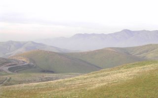 Here's a view the Joad family from John Steinbeck's "The Grapes of Wrath" might have recognized: the Promised Land, the Central Valley of California! Descending into the Central Valley from the heights of the Tehachapi Mountains (January 5, 2006).
Returning to California, the surface air in the whole Central Valley was filled with fine particulate matter, almost like a white smoke. It's about the right time and place: I wonder if ammonium nitrate generation had gone hog wild, like it sometimes does in California in the winter?
Link
"Ballet Russes" Coming To Sacramento!
Yippee! Here's what Deborah says:
Link
Yippee! Here's what Deborah says:
You're lucky--it's coming to your town, too:WHAT!!! I did not know! They must have extended its run! Wait! Goldfine did say they were trying to get it to Sacramento. I'm glad they have succeeded!
Sacramento Crest Theatre - Feb 3, 2006
Link
Looking For The Ghost of Sam Kinison
For reasons hard to describe, I've been looking for the highway location where the comic Sam Kinison was fatally-injured on April 10, 1992. I mean, I wasn't all that fond of Sam Kinison when he was alive (a bit too crude for my taste), but one can only sympathize with having his promising life cut short in the desert by a 17-year-old drunk driver. And in any event, my taste has deteriorated since the 90's, so today, I'd probably be a big fan.
Even New Mexico, the drunkest-drivingest capital of the country, has been cracking down on drunk driving, finally getting rid of that ultimate modern convenience, the liquor store drive-up window. New Mexico's tolerance for drunken driving has seriously constricted, especially after the horrible 1992 Gordon House accident that wiped out nearly an entire family west of Albuquerque on I-40. There were three trials (two juries deadlocked), with several changes of venue, so the entire state got to hear the sad details, over and over again, for several years. No sentient individual in the state could ignore the case, no matter how much they wished it to go away. Ultimately, the third jury found the talented (but momentarily weak) House guilty, and sent him to prison for 22 years.
The Kinison accident location is on Highway 95 near the California/Nevada state line, apparently somewhere between the I-40 junction, and the turnoff to Laughlin, NV on Highway 77.
On the drive to Albuquerque, I scoped out the area, under the impression that the site was just south of the Highway 77 turnoff, and located two descansos, or roadside crosses, in the general vicinity, but one cross seemed to be too far north and the other cross seemed to be too far south to be the correct location.
On the way back from Albuquerque, I logged onto the Internet in the Mohave County library in Bullhead City, AZ, and located a Web Site that suggested that the accident site is 3 to 4 miles north of I-40: still vague, but better than nothing. Nevertheless, after weaving and meandering and dodging RVs and semi-trailers all along Highway 95, from I-40 to the Goffs Road junction, I wasn't able to locate any specific accident site (the previously-located southern cross apparently belonged to "Jeff"). So, either I was looking in the wrong place, or the location has no monument.
Looking at the Web today, I located this Web Site, which suggests I missed a few, subtle clues...
Maybe Howard Stern and Adam Carolla can get together and put up a suitable marker....
Link
Remainder Table
Travelling along the Colorado River strip in Bullhead City, AZ, I saw a truly gigantic Wal-Mart Supercenter perched on a slope above the road. Remembering that Wal-Mart is the only store I know that carries 3-inch-wide masking tape (good for lint removal), I decided to stop and shop.
They only had 2-inch-wide tape at this Wal-Mart, but they did have a surfeit of other merchandise, including maps and atlases, plus two books I picked up from the remainder table: an autobiography of the pop singer Chaka Khan, "Chaka! - Through The Fire" ($3.94), and that great classic of 19th-Century science, and perhaps the greatest book of the entire century, Charles Darwin's "The Origin of the Species" ($7.87).
The checkout clerk thoughtfully paged through both books, looking with particular interest at the illustrations in Darwin's book (reproductions of the originals). She said, with what seemed to be a bit of disdain about the laborious process involved, that she doesn't read much: in fact, the only book she reads is "The Bible." She said that she gets all her information from TV, since there is way too much reading involved to get information off the Internet, and that she has trouble even reading employment application forms.
I sympathized with her about the employment application forms. Have you ever seen those SR-71's? No, wait, that's the Mach 3 high-altitude spy plane - I mean the federal form SF-171, or its current successor? Quite an involved form! It can take hours to fill out!
Truth be told, reading IS a pretty laborious and troublesome activity.
Back From Trip
Returned last night about 9 p.m. I'll be blogging about what I saw, with posts mostly arranged by topic. I will add photos when available (I had two extra cameras, and film has yet to be developed from them). Here was the approximate itinerary:
December 27: Left Sacramento at 8 a.m. Travelled south along Highway 99 through Bakersfield, then along Highway 58 to Barstow, and then I-15 to Las Vegas. Stayed overnight with Ira's family.
December 28: Travelled SE from Las Vegas, along Highway 95, to Needles, CA. Raced along I-40 to Albuquerque. Stayed at father's residence.
December 29: Loafed in ABQ.
December 30: Continued loafing. Visited north side of Alameda Bridge across the Rio Grande River. Saw "The Producers."
December 31: Continued loafing. Visited south side of Alameda Bridge. Visited downtown ABQ to see what New Year's Eve was like there.
January 1: Visited friends Karl & Karen. Saw "Munich."
January 2: Traveled south along I-25 to Socorro, NM, and west along Highway 60 to the VLA, Springerville, Show Low, Globe, and finally arrived in Mesa, AZ. Stayed with cousins Bruce & Donna at Aunt Millie's senior citizen residence (Sun Terrace) in Mesa.
January 3: Visited Aunt Helen (age 99) at Emerald Groves. Pleasant dinner with Deborah McMillion-Nering, her husband Doug, and James Bucanek.
January 4: Travelled west along I-10 to Blythe, CA, then north along Highway 95 to Bullhead City, AZ. Stayed in a motel there.
January 5: Travelled back to Needles along Highway 95. Hunted for site of Sam Kenison's death. Traveled along I-40 to Barstow, then to Bakersfield along Highway 58, then along Highway 99 to Sacramento (nailing a cat in Tulare).
Mileage upon:
departure from Sacramento - 55,768.
departure from Albuquerque - 57,141.
arrival at Sacramento - 58,543.
Total mileage - 2,775.

